
– Lat/Long: 40.20° S 148.07° E
 Strzelecki Peaks
Weather Forecast, AustraliaIssued: 3 pm Fri 25 Apr Local TimeUpdates in: hr min sUpdate imminent
Strzelecki Peaks Weather Forecast, Australia
Issued: 3 pm Fri 25 Apr Local Time
Updates in:
Update imminent hr min s

Issued: 3 pm Fri 25 Apr Local Time
Updates in:
Update imminent hr min s
Days 1–4 Weather SummarySome drizzle, heaviest during Fri night. Very mild (max 18°C on Fri afternoon, min 15°C on Sun morning). Wind will be generally light. | Days 5–7 Weather SummaryLight rain (total 7mm), mostly falling on Tue morning. Very mild (max 16°C on Mon afternoon, min 11°C on Tue night). Winds increasing (calm on Mon night, near gales from the SSE by Tue morning). | ||||||||||||||||
Fri 25 | Saturday 26 | Sunday 27 | Monday 28 | Tuesday 29 | Wednesday 30 | ||||||||||||
PM | night | AM | PM | night | AM | PM | night | AM | PM | night | AM | PM | night | AM | PM | night | |
cloudy | light rain | some clouds | clear | clear | clear | clear | rain shwrs | light rain | light rain | light rain | light rain | rain shwrs | rain shwrs | rain shwrs | rain shwrs | some clouds | |
km/h | |||||||||||||||||
 |  |  |  |  |  | ||||||||||||
— | — | — | — | — | — | — | — | — | — | — | — | — | — | — | — | — | |
— | 1.1 | — | — | — | — | — | 0.1 | 0.1 | 0.4 | 1.3 | 4 | 0.1 | 0.2 | 0.6 | 0.3 | — | |
max°C | 18 | 17 | 17 | 17 | 16 | 16 | 15 | 16 | 17 | 16 | 16 | 14 | 14 | 13 | 13 | 13 | 12 |
min°C | 18 | 16 | 17 | 17 | 16 | 15 | 15 | 15 | 17 | 15 | 15 | 13 | 14 | 11 | 11 | 13 | 12 |
18 | 16 | 17 | 17 | 16 | 14 | 14 | 15 | 16 | 14 | 14 | 9 | 11 | 8 | 8 | 10 | 9 | |
3000 | 2900 | 2850 | 2900 | 3100 | 3250 | 3150 | 3050 | 2900 | 2850 | 2700 | 2250 | 1950 | 1550 | 1450 | 1450 | 1500 | |
Cloud base (m) | 2900 | 400 | 2050 | 2100 | 2850 | 450 | 500 | 300 | 400 | 200 | 250 | 300 | 700 | 600 | 500 | 1000 | |
— | — | 6:47 | — | — | 6:48 | — | — | 6:48 | — | — | 6:50 | — | — | 6:50 | — | — | |
5:24 | — | — | 5:22 | — | — | 5:22 | — | — | 5:21 | — | — | 5:19 | — | — | 5:17 | — | |
Loading...
Strzelecki Peaks Weather (Days 0-3):
The weather forecast for Strzelecki Peaks is: Some drizzle, heaviest during Fri night. Very mild (max 18°C on Fri afternoon, min 15°C on Sun morning). Wind will be generally light.
Strzelecki Peaks Weather (Days 3-6):
Light rain (total 7mm), mostly falling on Tue morning. Very mild (max 16°C on Mon afternoon, min 11°C on Tue night). Winds increasing (calm on Mon night, near gales from the SSE by Tue morning).
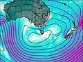
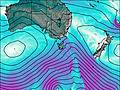
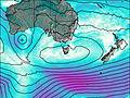
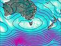
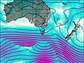
This table gives the weather forecast for Strzelecki Peaks at the specific elevation of 0 m. Our advanced weather models allow us to provide distinct weather forecasts for several elevations of Strzelecki Peaks. To see the weather forecasts for the other elevations, use the tab navigation above the table. For a wider overview of the weather, consult the Weather Map of Tasmania.
| Weather Station | Temp. | Weather | Wind | Gusts | Cloud / Visibility |
|---|---|---|---|---|---|
FlindersIslandAirport | |||||
Swan Island | |||||
Larapuna(EddystonePoint) | |||||
Scottsdale(West Minstone Road) | |||||
STHelensAerodrome | |||||
HoganIsland | |||||
Launceston (TI Tree Bend) | |||||
Launceston Airport | |||||
* NOTE: not all weather observatories update at the same frequency which is the reason why some locations may show data from stations that are further away than known closer ones.

