– Lat/Long: 28.60° N 61.13° E
 تفتان
تفتان
Weather Forecast, IranIssued: 2 am Sat 19 Apr Local TimeUpdates in: hr min sUpdate imminent
تفتان Weather Forecast, Iran
Issued: 2 am Sat 19 Apr Local Time
Updates in:
Update imminent hr min s

Issued: 2 am Sat 19 Apr Local Time
Updates in:
Update imminent hr min s
Days 1–3 Weather SummaryMostly dry. Freeze-thaw conditions (max 3°C on Mon afternoon, min -1°C on Sat morning). Winds decreasing (strong winds from the W on Sat morning, light winds from the WSW by Mon morning). | Days 4–6 Weather SummaryMostly dry. Mild temperatures (max 7°C on Thu afternoon, min 2°C on Tue morning). Winds decreasing (fresh winds from the WNW on Wed night, light winds from the NW by Thu afternoon). | |||||||||||||||||
Saturday 19 | Sunday 20 | Monday 21 | Tuesday 22 | Wednesday 23 | Thursday 24 | |||||||||||||
AM | PM | night | AM | PM | night | AM | PM | night | AM | PM | night | AM | PM | night | AM | PM | night | |
clear | clear | clear | clear | clear | clear | clear | clear | clear | clear | clear | clear | clear | clear | clear | some clouds | some clouds | clear | |
km/h | ||||||||||||||||||
 |  |  |  |  |  | |||||||||||||
— | — | — | — | — | — | — | — | — | — | — | — | — | — | — | — | — | — | |
— | — | — | — | — | — | — | — | — | — | — | — | — | — | — | — | — | — | |
max°C | 0 | 0 | 0 | 0 | 1 | 1 | 1 | 3 | 2 | 4 | 4 | 3 | 5 | 6 | 5 | 6 | 7 | 6 |
min°C | -1 | 0 | -1 | -1 | 0 | 0 | 0 | 2 | 2 | 2 | 4 | 3 | 4 | 5 | 4 | 5 | 7 | 6 |
-9 | -8 | -8 | -7 | -7 | -6 | -5 | -2 | -3 | -2 | 0 | -2 | 0 | 1 | -1 | 2 | 4 | 4 | |
3900 | 4100 | 4050 | 3900 | 4100 | 4050 | 4100 | 4300 | 4300 | 4350 | 4600 | 4450 | 4550 | 4750 | 4700 | 4700 | 4850 | 4850 | |
Cloud base (m) | 8400 | 5650 | 5750 | |||||||||||||||
4:56 | — | — | 4:54 | — | — | 4:54 | — | — | 4:52 | — | — | 4:52 | — | — | 4:50 | — | — | |
— | 5:52 | — | — | 5:53 | — | — | 5:53 | — | — | 5:54 | — | — | 5:54 | — | — | 5:55 | — | |
Loading...
تفتان Weather (Days 0-3):
The weather forecast for تفتان is: Mostly dry. Freeze-thaw conditions (max 3°C on Mon afternoon, min -1°C on Sat morning). Winds decreasing (strong winds from the W on Sat morning, light winds from the WSW by Mon morning).
تفتان Weather (Days 3-6):
Mostly dry. Mild temperatures (max 7°C on Thu afternoon, min 2°C on Tue morning). Winds decreasing (fresh winds from the WNW on Wed night, light winds from the NW by Thu afternoon).
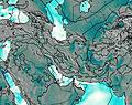
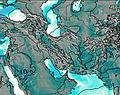
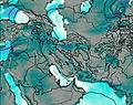
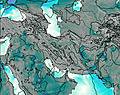
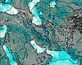
This table gives the weather forecast for تفتان at the specific elevation of 4050 m. Our advanced weather models allow us to provide distinct weather forecasts for several elevations of تفتان. To see the weather forecasts for the other elevations, use the tab navigation above the table. For a wider overview of the weather, consult the Weather Map of Iran.
* NOTE: not all weather observatories update at the same frequency which is the reason why some locations may show data from stations that are further away than known closer ones.
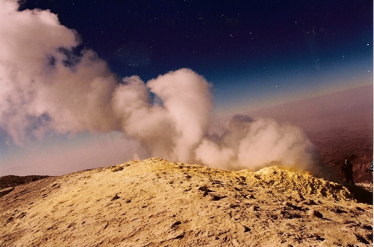
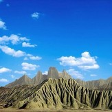
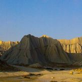
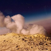
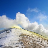
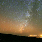
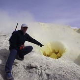
تفتان Photos
View all
photos (822) |
Zagros photos (1203) |
photos from mountains in Iran (11692) |
all photos
 Upload new photo
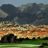
 See 94 more تفتان photos
naser ramezani martial mountain
naser ramezani martial mountain
naser ramezani martial mountain
Naser Ramezani
taftan
milky way
masoud esnaasharan

