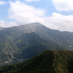
Tai Mo Shan (大帽山) guide
- Elevation: 957 m
- Difficulty:
- Best months to climb:
- Convenient center:
Tai Mo Shan (大帽山) Climbing Notes
Bennett from HONG KONG writes:
Fall is the best time to hike Tai Mo Shan; especially right after a rainstorm, because you will be perched over a spectacular blanket of clouds. Hiking from the food/drink kiosk near the parking lot, following the road up to the to the summit will take about 45 mins to 1 hour. Not a very intense hike, but there will be some incline so bring water, good shoes, a rain jacket and sunscreen (this is Hong Kong's highest mountain, after all). Be warned in winter it can be quite cool on the mountain (6-16 degrees c with wind chill), and in summer direct, blisteringly hot sunshine bakes the mountain and the hiker. There is no cover whatsoever near the summit, and heat exhaustion could be a concern. Mind your feet; there are lots of cow patties everywhere. Be on the lookout for Wild Boar and Feral Cows that frequent the bottom half of the mountain.
After reaching the summit, and if you feel the need to cool down, hike about an hour down the mountain to one of Hong Kong's most spectacular hidden gems; Ng Tung Chai Waterfall for a dip in one of its 4 turquoise pools. All 4 are secluded in lush jungle and the Main Fall is over 30 meters high.
If you are well prepared, Tai Mo Shan grants majestical views of practically all of Hong Kong. The hike up is rewarding no matter what time of the year. It remains one of my favorite summits in Hong Kong.
2020-09-21 |
Click here to submit your own climbing note for Tai Mo Shan (大帽山)
|

Select Tai Mo Shan (大帽山) Location Map Detail:
Use this relief map to navigate to mountain peaks in the area of Tai Mo Shan (大帽山).
10 other mountain peaks closest to Tai Mo Shan (大帽山):


 Like us
 Follow us
 Follow us