– Lat/Long: 65.40° N 12.09° E
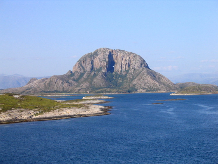
 Torghatten
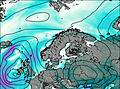
Weather Forecast, NorwayIssued: 7 am Thu 24 Apr Local TimeUpdates in: hr min sUpdate imminent
Torghatten Weather Forecast, Norway
Issued: 7 am Thu 24 Apr Local Time
Updates in:
Update imminent hr min s

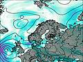
Issued: 7 am Thu 24 Apr Local Time
Updates in:
Update imminent hr min s
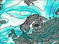
Days 1–3 Weather SummaryMostly dry. Freeze-thaw conditions (max 4°C on Sat night, min 0°C on Thu morning). Winds decreasing (strong winds from the N on Thu afternoon, calm by Sat morning). | Days 4–6 Weather SummaryHeavy rain (total 64mm), heaviest during Tue afternoon. Mild temperatures (max 6°C on Mon afternoon, min 3°C on Tue night). Winds increasing (moderate winds from the SSW on Sun night, near gales from the SW by Tue afternoon). | |||||||||||||||||
Thursday 24 | Friday 25 | Saturday 26 | Sunday 27 | Monday 28 | Tuesday 29 | |||||||||||||
AM | PM | night | AM | PM | night | AM | PM | night | AM | PM | night | AM | PM | night | AM | PM | night | |
some clouds | some clouds | cloudy | cloudy | some clouds | some clouds | clear | some clouds | cloudy | light rain | mod. rain | heavy rain | mod. rain | mod. rain | heavy rain | light rain | heavy rain | mod. rain | |
km/h | ||||||||||||||||||
 |  |  |  |  |  | |||||||||||||
— | — | — | — | — | — | — | — | — | — | — | — | — | — | — | — | — | — | |
— | — | — | — | — | — | — | — | — | 0.1 | 8 | 12 | 6 | 7 | 10 | 0.8 | 13 | 5 | |
max°C | 0 | 0 | 1 | 1 | 1 | 2 | 1 | 2 | 4 | 5 | 5 | 5 | 5 | 6 | 6 | 5 | 6 | 5 |
min°C | 0 | 0 | 0 | 0 | 1 | 1 | 1 | 1 | 2 | 4 | 4 | 5 | 5 | 5 | 5 | 5 | 6 | 3 |
-5 | -7 | -6 | -5 | -4 | -5 | 1 | 1 | 1 | -1 | -2 | 0 | 1 | -1 | -1 | -1 | 1 | -4 | |
250 | 300 | 300 | 350 | 400 | 450 | 450 | 550 | 1000 | 900 | 1200 | 1300 | 1250 | 1200 | 1250 | 1050 | 1500 | 700 | |
Cloud base (m) | 600 | 500 | 650 | 500 | 550 | 450 | 400 | 6100 | 750 | 250 | 250 | 200 | 150 | 150 | 150 | 50 | 100 | |
5:01 | — | — | 4:58 | — | — | 4:54 | — | — | 4:50 | — | — | 4:47 | — | — | 4:43 | — | — | |
— | — | 9:19 | — | — | 9:22 | — | — | 9:25 | — | — | 9:29 | — | — | 9:32 | — | — | 9:36 | |
Loading...
Torghatten Weather (Days 0-3):
The weather forecast for Torghatten is: Mostly dry. Freeze-thaw conditions (max 4°C on Sat night, min 0°C on Thu morning). Winds decreasing (strong winds from the N on Thu afternoon, calm by Sat morning).
Torghatten Weather (Days 3-6):
Heavy rain (total 64mm), heaviest during Tue afternoon. Mild temperatures (max 6°C on Mon afternoon, min 3°C on Tue night). Winds increasing (moderate winds from the SSW on Sun night, near gales from the SW by Tue afternoon).
This table gives the weather forecast for Torghatten at the specific elevation of 258 m. Our advanced weather models allow us to provide distinct weather forecasts for several elevations of Torghatten. To see the weather forecasts for the other elevations, use the tab navigation above the table. For a wider overview of the weather, consult the Weather Map of Norway.
| Weather Station | Temp. | Weather | Wind | Gusts | Cloud / Visibility |
|---|---|---|---|---|---|
Bronnoysund AP | |||||
Vega-Vallsjo | |||||
Sklinna LH | |||||
Mosjoe / jaersta Airport | |||||
* NOTE: not all weather observatories update at the same frequency which is the reason why some locations may show data from stations that are further away than known closer ones.
Torghatten Photos
View all
photos (8) |
Scandinavia/European Arctic Ranges photos (14) |
photos from mountains in Norway (113) |
all photos
 Upload new photo
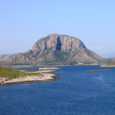
Torghatten

