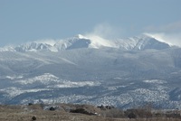
Truchas Peak guide
- Elevation: 3994 m
- Difficulty: Walk up
- Best months to climb: May, June, July, August, September
- Convenient center: Espanola
Truchas Peak Climbing Notes
Annie M from UNITED STATES writes:
Hiked to middle Truchas Peak (13;107) on 7/28/18 via Rio Quemado TH. Lots of dead-fall across trail until you come to the meadow. Cross the scree field. Then it’s straight up the grassy shoot between the rock. It’s an easy hike to the summit once you get up that hill! Watch for the big horned sheep! Amazing views!
2018-07-30 |
Click here to submit your own climbing note for Truchas Peak
|

Select Truchas Peak Location Map Detail:
Use this relief map to navigate to mountain peaks in the area of Truchas Peak.
10 other mountain peaks closest to Truchas Peak:


 Like us
 Follow us
 Follow us