
– Lat/Long: 49.04° N 113.86° W
 Vimy Peak
Weather Forecast, CanadaIssued: 11 pm Thu 24 Apr Local TimeUpdates in: 1hr 1min 25sUpdate imminent
Issued: 11 pm Thu 24 Apr Local Time
Updates in:
Update imminent 1hr 1min 25s

Issued: 11 pm Thu 24 Apr Local Time
Updates in:
Update imminent 1hr 1min 25s
Days 1–4 Weather SummaryMostly dry. Freeze-thaw conditions (max 5°C on Fri afternoon, min -2°C on Thu night). Wind will be generally light. | Days 5–7 Weather SummaryA dusting of new snow. Freeze-thaw conditions (max 3°C on Wed afternoon, min -6°C on Sun night). Winds increasing (calm on Sun night, fresh winds from the WSW by Mon night). | ||||||||||||||||||
Friday 25 | Saturday 26 | Sunday 27 | Monday 28 | Tuesday 29 | Wednesday 30 | ||||||||||||||
night | AM | PM | night | AM | PM | night | AM | PM | night | AM | PM | night | AM | PM | night | AM | PM | night | |
clear | clear | clear | clear | some clouds | some clouds | rain shwrs | cloudy | cloudy | light snow | some clouds | some clouds | some clouds | some clouds | cloudy | some clouds | some clouds | rain shwrs | clear | |
mph | |||||||||||||||||||
 |  |  |  |  |  |  | |||||||||||||
— | — | — | — | — | — | — | — | — | 1 | — | — | — | — | — | — | — | — | — | |
— | — | — | — | — | — | 0.02 | — | — | — | — | — | — | — | — | — | — | 0.00 | — | |
max°F | 30 | 37 | 41 | 36 | 39 | 41 | 39 | 30 | 30 | 27 | 30 | 34 | 34 | 34 | 32 | 30 | 32 | 37 | 37 |
min°F | 28 | 36 | 39 | 36 | 37 | 41 | 32 | 30 | 30 | 21 | 27 | 32 | 32 | 32 | 32 | 28 | 30 | 36 | 36 |
25 | 32 | 39 | 30 | 36 | 37 | 32 | 30 | 30 | 14 | 21 | 23 | 19 | 21 | 21 | 25 | 27 | 30 | 30 | |
6200 | 8700 | 9400 | 9700 | 9400 | 9700 | 9400 | 7200 | 6700 | 5400 | 5100 | 8000 | 8900 | 8200 | 8000 | 7100 | 7100 | 8500 | 10300 | |
Cloud base (ft) | 9800 | — | — | — | — | — | 10300 | 5700 | 5600 | 5700 | 5600 | 7500 | 6700 | 6100 | 7100 | 7100 | 5600 | 7700 | — |
— | 6:24 | — | — | 6:22 | — | — | 6:22 | — | — | 6:20 | — | — | 6:18 | — | — | 6:16 | — | — | |
— | — | 8:42 | — | — | 8:43 | — | — | 8:45 | — | — | 8:45 | — | — | 8:47 | — | — | 8:49 | — | |
Days 7-12 Weather Summary
Interested in the 12-day Forecast? Unlock the full forecast and many more features by becoming a Pro member.
 MountainPro
Your membership benefits:
- Expert mountain forecasts
- 12 day forecast
- Hourly forecast detail
- Offline mapping (app only)
- Unlock our mobile app
- Remove ads
Vimy Peak Weather (Days 0-3):
The weather forecast for Vimy Peak is: Mostly dry. Freeze-thaw conditions (max 5°C on Fri afternoon, min -2°C on Thu night). Wind will be generally light.
Vimy Peak Weather (Days 3-6):
A dusting of new snow. Freeze-thaw conditions (max 3°C on Wed afternoon, min -6°C on Sun night). Winds increasing (calm on Sun night, fresh winds from the WSW by Mon night).
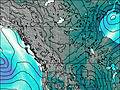
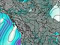
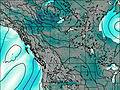
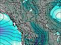
This table gives the weather forecast for Vimy Peak at the specific elevation of 2379 m. Our advanced weather models allow us to provide distinct weather forecasts for several elevations of Vimy Peak. To see the weather forecasts for the other elevations, use the tab navigation above the table. For a wider overview of the weather, consult the Weather Map of Alberta.
| Weather Station | Temp. | Weather | Wind | Gusts | Cloud / Visibility |
|---|---|---|---|---|---|
WatertonParkGate- Alta | |||||
Bullhorn Headwaters- Alta | |||||
Carway-Alta | |||||
Bullhorn Coulee Reservoir- Alta | |||||
Cardston- Alta | |||||
Pincher Creek Airport | |||||
Pincher Creek Climate- Alta |
* NOTE: not all weather observatories update at the same frequency which is the reason why some locations may show data from stations that are further away than known closer ones.

