– Lat/Long: 46.12° N 8.00° E

SzWeissmies – Climbing, Hiking & Mountaineering information

Placeholder

Weissmies mountain guide

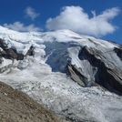
Weissmies photo

Weissmies

Photo credit:

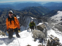
Not quite at the summit yet!, Weissmies photo

Weissmies

Photo credit: Alex Fitzgerald-Barron

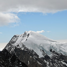
Weissmies photo

Weissmies

Photo credit: P.Kooistra

  • Elevation: 4023 m
  • Difficulty: Basic Snow and Ice Climb
  • Best months to climb: July, August
  • Convenient center: Saas Grund

Weissmies Climbing Notes

KJ from LUXEMBOURG writes:

Hello,
Can anyone tell me what's the current situation up in the mountain. I was going to make my ascent on Sunday or Monday 13 or 14 August.
Proper gear and experience in place.
Many thanks,
KJ

2017-08-10

Click here to submit your own climbing note for Weissmies

Weissmies Location Map

Select Weissmies Location Map Detail:


Latest Gallery Images for Weissmies

visit the
gallery
or click to view
Weissmies and Trift GlacierWeissmiesWeissmies view from LagginhornAlpy szwajcarskie

Upload your photo of Weissmies

Select a mountain summit from the menu
Select a Mountain Summit
Surf breaks located close to Weissmies Mountain peaks around Weissmies Roads and rivers around Weissmies

Use this relief map to navigate to mountain peaks in the area of Weissmies.

10 other mountain peaks closest to Weissmies:

1. Tällihorn (3448 m) 3.0 km
2. Portjengrat (3654 m) 3.2 km
3. Almagellhorn (3337 m) 3.4 km
4. Lagginhorn (4010 m) 4.5 km
5. Jegihorn (3206 m) 4.5 km
6. Sonnighorn (3487 m) 5.1 km
7. Inner Rothorn (3455 m) 5.4 km
8. Fletschhorn (3993 m) 5.7 km
9. Balmahorn (2870 m) 6.3 km
10. Senggchuppa (3607 m) 6.9 km