– Lat/Long: 38.06° N 107.51° W
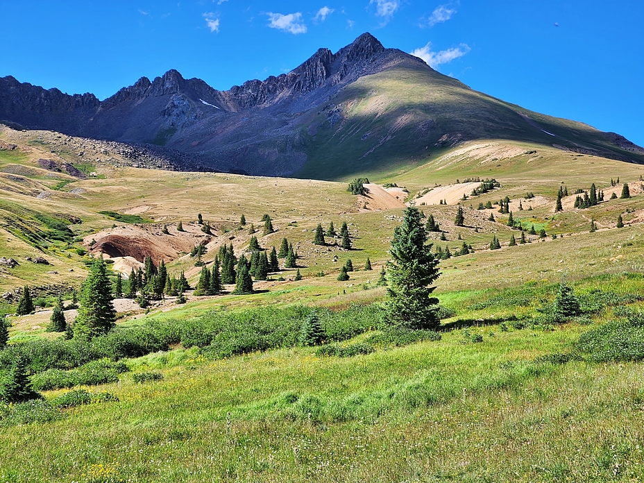
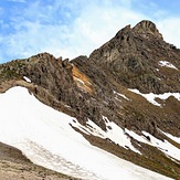
 Wetterhorn Peak
Weather Forecast, United StatesIssued: 5 am Tue 21 Apr Local TimeUpdates in: hr min sUpdate imminent
Issued: 5 am Tue 21 Apr Local Time
Updates in:
Update imminent hr min s

Issued: 5 am Tue 21 Apr Local Time
Updates in:
Update imminent hr min s
Days 1–3 Weather SummaryMostly dry. Temperatures will be below freezing (max 0°C on Tue morning, min -13°C on Wed night). Winds increasing (light winds from the SSW on Tue morning, near gales from the SW by Wed afternoon). | Days 4–6 Weather SummaryA dusting of new snow. Temperatures will be below freezing (max -4°C on Sat morning, min -11°C on Sun night). Winds decreasing (strong winds from the WSW on Sat morning, moderate winds from the WSW by Sun night). | |||||||||||||||||
Tuesday 21 | Wednesday 22 | Thursday 23 | Friday 24 | Saturday 25 | Sunday 26 | |||||||||||||
AM | PM | night | AM | PM | night | AM | PM | night | AM | PM | night | AM | PM | night | AM | PM | night | |
clear | some clouds | clear | clear | some clouds | some clouds | clear | clear | clear | clear | cloudy | snow shwrs | cloudy | cloudy | snow shwrs | snow shwrs | some clouds | clear | |
km/h | ||||||||||||||||||
 |  |  |  |  |  | |||||||||||||
— | — | — | — | — | — | — | — | — | — | — | 1 | — | — | 2 | 1 | — | — | |
— | — | — | — | — | — | — | — | — | — | — | — | — | — | — | — | — | — | |
max °C | 0 | 0 | -2 | -2 | -1 | -6 | -8 | -7 | -10 | -6 | -5 | -6 | -4 | -4 | -7 | -7 | -7 | -10 |
min °C | -2 | -1 | -5 | -4 | -3 | -13 | -11 | -7 | -10 | -8 | -5 | -9 | -7 | -5 | -9 | -8 | -8 | -11 |
-5 | -4 | -13 | -12 | -13 | -26 | -21 | -16 | -19 | -18 | -14 | -19 | -18 | -14 | -19 | -18 | -18 | -19 | |
4000 | 4250 | 3850 | 3650 | 4150 | 2950 | 2650 | 3450 | 2850 | 3150 | 3700 | 3300 | 3350 | 3750 | 3100 | 3100 | 3350 | 2700 | |
Cloud base (m) | 5100 | 9350 | 6500 | 6150 | 6100 | 4300 | 5350 | 3600 | 4000 | 4150 | 4250 | |||||||
6:26 | — | — | 6:24 | — | — | 6:24 | — | — | 6:22 | — | — | 6:20 | — | — | 6:20 | — | — | |
— | 7:51 | — | — | 7:52 | — | — | 7:52 | — | — | 7:53 | — | — | 7:54 | — | — | 7:55 | — | |
Loading...
Wetterhorn Peak Weather (Days 0-3):
The weather forecast for Wetterhorn Peak is: Mostly dry. Temperatures will be below freezing (max 0°C on Tue morning, min -13°C on Wed night). Winds increasing (light winds from the SSW on Tue morning, near gales from the SW by Wed afternoon).
Wetterhorn Peak Weather (Days 3-6):
A dusting of new snow. Temperatures will be below freezing (max -4°C on Sat morning, min -11°C on Sun night). Winds decreasing (strong winds from the WSW on Sat morning, moderate winds from the WSW by Sun night).
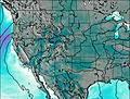
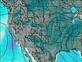
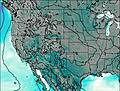
This table gives the weather forecast for Wetterhorn Peak at the specific elevation of 4272 m. Our advanced weather models allow us to provide distinct weather forecasts for several elevations of Wetterhorn Peak. To see the weather forecasts for the other elevations, use the tab navigation above the table. For a wider overview of the weather, consult the Weather Map of Colorado.
| Weather Station | Temp. | Weather | Wind | Gusts | Cloud / Visibility |
|---|---|---|---|---|---|
Telluride Region Airport | |||||
Montrose Airport | |||||
Gunnison Airport | |||||
* NOTE: not all weather observatories update at the same frequency which is the reason why some locations may show data from stations that are further away than known closer ones.
Wetterhorn Peak Photos
View all
San Juan Mountains photos (13) |
Rocky Mountains (USA) photos (298) |
photos from mountains in United States (3035) |
all photos
 Upload new photo
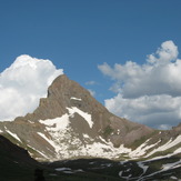
Wetterhorn Peak
Wetterhorn Peak
Wetterhorn Peak