Wheeler Peak guide
- Elevation: 13160 ft
- Difficulty: Walk up
- Best months to climb: March, April, May, June, July, August, September, October, November
- Convenient center: Taos, New Mexico
Wheeler Peak Climbing Notes
michael turri from UNITED STATES writes:
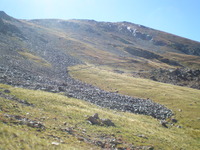
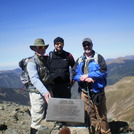
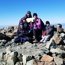
A friend of mine & I took the East Fork route out of Red River the first part of June in 2016. We started off at 7 am. Very pretty scenery the entire route. We crossed the stream that comes down out of Horseshoe Lake multiple times. You cannot drink this water no matter how wonderful it looks. We packed in our own water, about a gallon each. Next time we will bring water purification devices. We crossed this amazing scree field with calichi covered rocks that were just amazing in color. When we got to Horseshoe lake we took about a half hour break just to enjoy the scenery there. I tried fishing, but was not properly equipped. The water there is CRYSTAL clear and is supposedly still stocked by air. From Horseshoe we made the final ascent to Wheeler. I found this more strenuous than all the previous hiking. Once on top, we signed the book, took lots of pics and fought off the Marmots & other critters trying to make off with our lunch. We decided to try and shorten our descent by not taking the trail we had just come up from Horseshoe. We went over the top, so to speak. We took the ridgeline from Wheeler back down to Horseshoe. It saved us about 45 minutes, but it was sure tough on my knees. We made it back to the car at about 6 pm. I will admit, I was TIRED. I was 64 back then and in pretty good shape, but at almost 16 miles round trip, it was a day! Be sure you check the upcoming weather before you attempt any of the 4 different routes up. We really lucked-out and had nothing but blue skies and no wind. Not always the story up there as other posts have indicated. Again, PLENTY of water and lots of high energy snacks. Well worth the hike to see the views from up top.
2018-01-09 |
Click here to read 5 more climbing notes for Wheeler Peak or submit your own
|

Select Wheeler Peak Location Map Detail:
Use this relief map to navigate to mountain peaks in the area of Wheeler Peak.
10 other mountain peaks closest to Wheeler Peak:


 Like us
 Follow us
 Follow us