Arc Dome climbing notes shared by Mountain-Forecast users
Click here to submit your own climbing note for Arc Dome
(NOTE: Texts may be edited by our content team for the purposes of ensuring accurate and relevant information)
-
July 06, 2014
Tom G from United States
There are two routes to Arc Dome I chose Stewart Creek Trail. The other tail is a jeep trail on which I returned.
The first forest is an Aspen forest and a lot of trees were marked. Some carvings dated back to 1923.
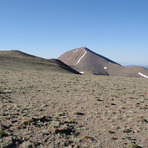
Then it was a steep climb through Aspen, through Bristlecone, and then through scrubs trees eventually to a small saddle. Unfortunately after the saddle you drop back into a valley and give up 600 feet of elevation before climbing again. After regaining the elevation you finally get to the high plateau. You give up another 600 feet of elevation before the steep 28 switchbacks to the summit
The benefit of the jeep trail is not giving up elevation, but the detriment is walking in all sage and open terrain (I got pretty sunburned in the face). However, there are some great views of Aspen valleys below on this route.
(NOTE: Texts may be edited by our content team for the purposes of ensuring accurate and relevant information)
Tom G from United States
There are two routes to Arc Dome I chose Stewart Creek Trail. The other tail is a jeep trail on which I returned.
The first forest is an Aspen forest and a lot of trees were marked. Some carvings dated back to 1923.
Then it was a steep climb through Aspen, through Bristlecone, and then through scrubs trees eventually to a small saddle. Unfortunately after the saddle you drop back into a valley and give up 600 feet of elevation before climbing again. After regaining the elevation you finally get to the high plateau. You give up another 600 feet of elevation before the steep 28 switchbacks to the summit
The benefit of the jeep trail is not giving up elevation, but the detriment is walking in all sage and open terrain (I got pretty sunburned in the face). However, there are some great views of Aspen valleys below on this route.


 Like us
 Follow us
 Follow us