– Lat/Long: 56.80° N 5.00° W
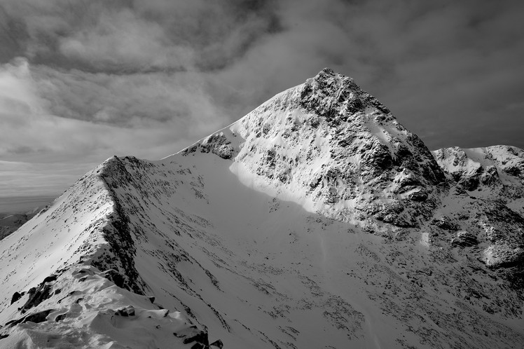
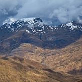
 Ben Nevis
Weather Forecast, United KingdomIssued: 12 am Sun 11 May Local TimeUpdates in: hr min sUpdate imminent
Issued: 12 am Sun 11 May Local Time
Updates in:
Update imminent hr min s

Issued: 12 am Sun 11 May Local Time
Updates in:
Update imminent hr min s
Days 1–4 Weather SummaryHeavy rain (total 26mm), heaviest during Sun night. Very mild (max 11°C on Tue afternoon, min 3°C on Sun night). Winds decreasing (fresh winds from the SE on Mon afternoon, calm by Tue morning). | Days 5–7 Weather SummaryMostly dry. Very mild (max 10°C on Tue night, min 7°C on Wed night). Wind will be generally light. | ||||||||||||||||||
Sunday 11 | Monday 12 | Tuesday 13 | Wednesday 14 | Thursday 15 | Friday 16 | ||||||||||||||
night | AM | PM | night | AM | PM | night | AM | PM | night | AM | PM | night | AM | PM | night | AM | PM | night | |
some clouds | cloudy | light rain | heavy rain | mod. rain | rain shwrs | clear | clear | clear | some clouds | some clouds | some clouds | clear | some clouds | some clouds | clear | clear | some clouds | some clouds | |
km/h | |||||||||||||||||||
 |  |  |  |  |  |  | |||||||||||||
— | — | — | — | — | — | — | — | — | — | — | — | — | — | — | — | — | — | — | |
— | — | 1.0 | 16 | 6 | 2 | — | — | — | — | — | — | — | — | — | — | — | — | — | |
max°C | 4 | 5 | 5 | 4 | 5 | 7 | 8 | 9 | 11 | 10 | 9 | 10 | 8 | 8 | 9 | 7 | 8 | 9 | 8 |
min°C | 4 | 4 | 4 | 3 | 3 | 5 | 8 | 9 | 11 | 9 | 9 | 9 | 7 | 7 | 9 | 7 | 8 | 8 | 8 |
-1 | 0 | 1 | 0 | 0 | 0 | 4 | 9 | 10 | 7 | 7 | 8 | 7 | 6 | 9 | 6 | 6 | 5 | 5 | |
2050 | 1950 | 2050 | 1950 | 2050 | 2450 | 2700 | 2750 | 2900 | 2950 | 2850 | 2900 | 2900 | 2850 | 2900 | 2850 | 2800 | 2800 | 2800 | |
Cloud base (m) | 1850 | 1900 | 700 | 300 | 300 | 300 | 900 | 9250 | 2000 | 2250 | 1800 | 6800 | |||||||
— | 5:11 | — | — | 5:09 | — | — | 5:07 | — | — | 5:05 | — | — | 5:03 | — | — | 5:01 | — | — | |
— | — | 9:22 | — | — | 9:23 | — | — | 9:25 | — | — | 9:28 | — | — | 9:30 | — | — | 9:31 | — | |
Loading...
Ben Nevis Weather (Days 0-3):
The weather forecast for Ben Nevis is: Heavy rain (total 26mm), heaviest during Sun night. Very mild (max 11°C on Tue afternoon, min 3°C on Sun night). Winds decreasing (fresh winds from the SE on Mon afternoon, calm by Tue morning).
Ben Nevis Weather (Days 3-6):
Mostly dry. Very mild (max 10°C on Tue night, min 7°C on Wed night). Wind will be generally light.
This table gives the weather forecast for Ben Nevis at the specific elevation of 1344 m. Our advanced weather models allow us to provide distinct weather forecasts for several elevations of Ben Nevis. To see the weather forecasts for the other elevations, use the tab navigation above the table. For a wider overview of the weather, consult the Weather Map of United Kingdom.
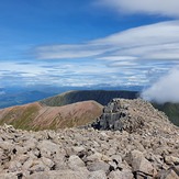
Ben Nevis Photos
View all
Grampians photos (156) |
Scottish Highlands photos (288) |
photos from mountains in United Kingdom (1967) |
all photos
 Upload new photo

 See 50 more Ben Nevis photos
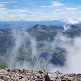
Misty View
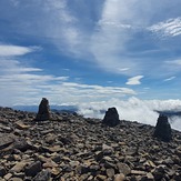
Top of The Ben
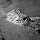
Ben Nevis
Ben Nevis
Ben Nevis
Ben Nevis