– Lat/Long: 56.80° N 5.00° W
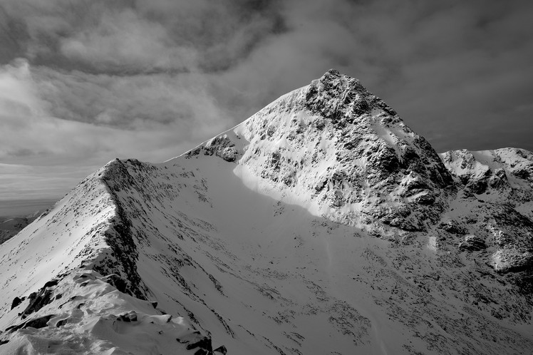
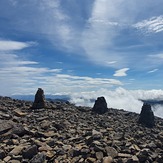
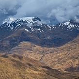
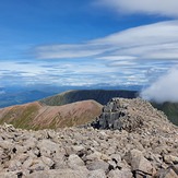
 Ben Nevis
Weather Forecast, United KingdomIssued: 12 am Tue 15 Apr Local TimeUpdates in: hr min sUpdate imminent
Ben Nevis Weather Forecast, United Kingdom
Issued: 12 am Tue 15 Apr Local Time
Updates in:
Update imminent hr min s

Issued: 12 am Tue 15 Apr Local Time
Updates in:
Update imminent hr min s
Days 1–4 Weather SummaryModerate rain (total 20mm) heaviest on Wed afternoon, then becoming colder with a dusting of snow on Wed night. Mild temperatures (max 6°C on Tue morning, min 1°C on Wed night). Wind will be generally light. | Days 5–7 Weather SummaryA moderate fall of snow heaviest on Fri night. Turning milder with heavy rain (total 22mm), heaviest during Fri night. Mild temperatures (max 5°C on Sat morning, min 1°C on Fri night). Winds increasing (calm on Thu night, fresh winds from the NE by Fri night). | ||||||||||||||||||
Tuesday 15 | Wednesday 16 | Thursday 17 | Friday 18 | Saturday 19 | Sunday 20 | ||||||||||||||
night | AM | PM | night | AM | PM | night | AM | PM | night | AM | PM | night | AM | PM | night | AM | PM | night | |
light rain | light rain | light rain | light rain | light rain | heavy rain | light snow | rain shwrs | rain shwrs | some clouds | light rain | light snow | mod. snow | light rain | light rain | light rain | light rain | light rain | rain shwrs | |
km/h | |||||||||||||||||||
 |  |  |  |  |  |  | |||||||||||||
— | — | — | — | — | — | 1.0 | — | — | — | — | 2.0 | 9 | — | — | — | — | — | — | |
0.7 | 0.5 | 0.4 | 0.4 | 0.4 | 12 | 4 | 0.7 | 1.0 | — | 0.8 | 3 | 10 | 2 | 2 | 2 | 0.7 | 0.7 | 0.2 | |
max°C | 4 | 6 | 6 | 4 | 3 | 3 | 3 | 5 | 5 | 4 | 4 | 2 | 3 | 5 | 5 | 5 | 3 | 4 | 4 |
min°C | 4 | 5 | 5 | 2 | 3 | 3 | 1 | 3 | 5 | 2 | 3 | 2 | 1 | 4 | 5 | 3 | 3 | 3 | 2 |
2 | 5 | 3 | -2 | -2 | -2 | -4 | 0 | 2 | -1 | -2 | -4 | -6 | -1 | 1 | -2 | -2 | -1 | -3 | |
1050 | 1100 | 1200 | 1000 | 900 | 1050 | 750 | 900 | 1100 | 1000 | 1000 | 800 | 850 | 1750 | 1750 | 1450 | 950 | 1000 | 950 | |
Cloud base (m) | 350 | 1750 | 750 | 300 | 250 | 200 | 250 | 750 | 750 | 4700 | 2550 | 250 | 250 | 200 | 200 | 200 | 300 | 200 | 350 |
— | 6:13 | — | — | 6:11 | — | — | 6:07 | — | — | 6:05 | — | — | 6:03 | — | — | 6:01 | — | — | |
— | — | 8:27 | — | — | 8:29 | — | — | 8:30 | — | — | 8:34 | — | — | 8:36 | — | — | 8:37 | — | |
Loading...
Ben Nevis Weather (Days 0-3):
The weather forecast for Ben Nevis is: Moderate rain (total 20mm) heaviest on Wed afternoon, then becoming colder with a dusting of snow on Wed night. Mild temperatures (max 6°C on Tue morning, min 1°C on Wed night). Wind will be generally light.
Ben Nevis Weather (Days 3-6):
A moderate fall of snow heaviest on Fri night. Turning milder with heavy rain (total 22mm), heaviest during Fri night. Mild temperatures (max 5°C on Sat morning, min 1°C on Fri night). Winds increasing (calm on Thu night, fresh winds from the NE by Fri night).
This table gives the weather forecast for Ben Nevis at the specific elevation of 500 m. Our advanced weather models allow us to provide distinct weather forecasts for several elevations of Ben Nevis. To see the weather forecasts for the other elevations, use the tab navigation above the table. For a wider overview of the weather, consult the Weather Map of United Kingdom.
Ben Nevis Photos
View all
Grampians photos (156) |
Scottish Highlands photos (288) |
photos from mountains in United Kingdom (1953) |
all photos
 Upload new photo
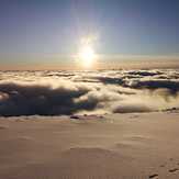

 See 50 more Ben Nevis photos
Misty View
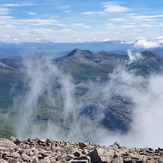
Top of The Ben
Ben Nevis
Ben Nevis
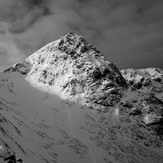
Ben Nevis
Ben Nevis

