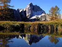
Jalovec guide
- Elevation: 2645 m
- Difficulty: Scramble
- Best months to climb: July to October
- Convenient center: Kranjska gora
Jalovec Climbing Notes
Joanna from SLOVENIA writes:
Our ascent of Jalovec took place 9/08/18. We set off from Koča pri Izviru Soče around 6 am. The trail goes through the conifer forest for about 2 hrs, it is extremely steep from the start yet fairly even underfoot (covered with needle leaves). Hiking poles are advisable due to the gradient of the path. When the forest ends, the stony route towards Zavitišče pod Špičkom (mountain hut) begins. About 20 minutes before the hut route splits, one way leading to the hut, the other in the direction of Jalovec. The route up the mountain involves scrambling all the way; it is occasionally protected by cables however for experienced hikers via ferrata kit is not compulsory (helmet is mandatory though). The route is exposed, especially its final section which goes through the ridge (great caution required). Upon reaching top of Jalovec there are several trails leading down the mountain. On 9/08/18 deep snow was present in Jalovcev Ozebnik and mark on the stone indicated that this route is closed. The trail is very well marked all the way, nonetheless, navigation can be difficult if the weather conditions are bad. Therefore this route should be undertaken only when the sky is clear and good weather is guaranteed. Zavitišče pod Špičkom offers food and hot/cold beverages if one wishes to recover after the climb. The way up to the mountain hut took us 3 hrs, from the hut to Jalovec - 1.5 hr.
2018-08-10 |
Click here to submit your own climbing note for Jalovec
|

Select Jalovec Location Map Detail:
Use this relief map to navigate to mountain peaks in the area of Jalovec.
10 other mountain peaks closest to Jalovec:


 Like us
 Follow us
 Follow us