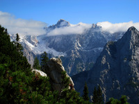
Škrlatica guide
- Elevation: 2740 m
- Difficulty:
- Best months to climb:
- Convenient center:
Škrlatica Climbing Notes
Joanna from UNITED KINGDOM writes:
We ascended Škrlatica on 4/08/2018 from Aljažev Dom. It is worth getting there early, especially during the summer season, as the parking fills up quickly and it might be difficult to find a spot later in the day. Besides, an early start will ensure cooler weather and crowd-free trail. In the beginning, the path leads through the forest and it is steep from the outset with various size rocks along the way, yet it is not difficult. After a couple of hours, Bivouac IV comes into view (on the left). From there we went over a scree and we approached a pasture. The trail goes down for a short while and momentarily it rises up again. There is a huge rock right before the final approach, where people leave rucksacks, hiking poles etc. A helmet is useful as occasionally rocks are falling down. The route up is secured in places but ferrata kit is not necessary (unless one needs extra protection). Some sections are exposed and the route provides a great opportunity to admire views of Julian Alps. On the top, there is a cross and a metal box with the book where one's climbing notes can be recorded. To descent follow the same route down.
2018-08-19 |
Click here to read 1 more climbing note for Škrlatica or submit your own
|

Select Škrlatica Location Map Detail:
Use this relief map to navigate to mountain peaks in the area of Škrlatica.
10 other mountain peaks closest to Škrlatica:


 Like us
 Follow us
 Follow us