– Lat/Long: 48.98° N 65.97° W
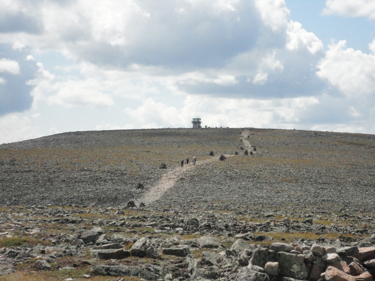
 Mont Jacques-Cartier
Weather Forecast, CanadaIssued: 7 am Fri 18 Apr Local TimeUpdates in: hr min sUpdate imminent
Mont Jacques-Cartier Weather Forecast, Canada
Issued: 7 am Fri 18 Apr Local Time
Updates in:
Update imminent hr min s

Issued: 7 am Fri 18 Apr Local Time
Updates in:
Update imminent hr min s
Days 1–3 Weather SummaryModerate rain (total 11mm) on Sat afternoon. Becoming colder with heavy fall of snow, heaviest during Sun afternoon. Freeze-thaw conditions (max 4°C on Sat afternoon, min -9°C on Sun morning). Winds increasing (moderate winds from the SW on Sat morning, stormy winds from the W by Sun morning). | Days 4–6 Weather SummaryA light covering of new snow mostly falling on Tue afternoon. Temperatures will be below freezing (max -3°C on Mon night, min -8°C on Mon morning). Winds decreasing (strong winds from the NNW on Mon morning, calm by Wed night). | |||||||||||||||||
Friday 18 | Saturday 19 | Sunday 20 | Monday 21 | Tuesday 22 | Wednesday 23 | |||||||||||||
AM | PM | night | AM | PM | night | AM | PM | night | AM | PM | night | AM | PM | night | AM | PM | night | |
some clouds | some clouds | cloudy | cloudy | heavy rain | light snow | mod. snow | heavy snow | light snow | cloudy | some clouds | cloudy | cloudy | light snow | light snow | some clouds | cloudy | some clouds | |
km/h | ||||||||||||||||||
 |  |  |  |  |  | |||||||||||||
— | — | — | — | — | 2.0 | 7 | 12 | 2.0 | — | — | — | — | 3 | 2.0 | — | — | — | |
— | — | — | — | 11 | — | — | — | — | — | — | — | — | — | — | — | — | — | |
max°C | -6 | -2 | 0 | 2 | 4 | 2 | -8 | -4 | -5 | -8 | -5 | -3 | -4 | -4 | -4 | -4 | -3 | -3 |
min°C | -7 | -5 | -3 | 0 | 4 | -6 | -9 | -5 | -8 | -8 | -6 | -5 | -4 | -4 | -4 | -4 | -3 | -4 |
-18 | -13 | -12 | -6 | -1 | -18 | -23 | -18 | -19 | -18 | -14 | -12 | -11 | -12 | -12 | -7 | -3 | -4 | |
400 | 800 | 800 | 2200 | 2550 | 1200 | 300 | 600 | 250 | 350 | 650 | 0 | 700 | 600 | 250 | 800 | 800 | 0 | |
Cloud base (m) | 500 | 600 | 550 | 450 | 400 | 400 | 400 | 450 | 500 | 500 | 550 | 550 | 1700 | 500 | 500 | 500 | 500 | 500 |
5:26 | — | — | 5:24 | — | — | 5:22 | — | — | 5:22 | — | — | 5:20 | — | — | 5:18 | — | — | |
— | 7:19 | — | — | 7:21 | — | — | 7:22 | — | — | 7:23 | — | — | 7:24 | — | — | 7:27 | — | |
Loading...
Mont Jacques-Cartier Weather (Days 0-3):
The weather forecast for Mont Jacques-Cartier is: Moderate rain (total 11mm) on Sat afternoon. Becoming colder with heavy fall of snow, heaviest during Sun afternoon. Freeze-thaw conditions (max 4°C on Sat afternoon, min -9°C on Sun morning). Winds increasing (moderate winds from the SW on Sat morning, stormy winds from the W by Sun morning).
Mont Jacques-Cartier Weather (Days 3-6):
A light covering of new snow mostly falling on Tue afternoon. Temperatures will be below freezing (max -3°C on Mon night, min -8°C on Mon morning). Winds decreasing (strong winds from the NNW on Mon morning, calm by Wed night).
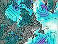
This table gives the weather forecast for Mont Jacques-Cartier at the specific elevation of 1268 m. Our advanced weather models allow us to provide distinct weather forecasts for several elevations of Mont Jacques-Cartier. To see the weather forecasts for the other elevations, use the tab navigation above the table. For a wider overview of the weather, consult the Weather Map of Quebec.
| Weather Station | Temp. | Weather | Wind | Gusts | Cloud / Visibility |
|---|---|---|---|---|---|
Cap -Chat- Que | |||||
Cap -Madeleine- Que | |||||
Cap Chat Airport | |||||
SHIP5518 | |||||
SHIP1567 | |||||
SHIP9286 | |||||
SHIP3811 | |||||
SHIP7136 | |||||
SHIP4436 |
* NOTE: not all weather observatories update at the same frequency which is the reason why some locations may show data from stations that are further away than known closer ones.
Mont Jacques-Cartier Photos
View all
Chic-Choc Mountains photos (7) |
Appalachians photos (861) |
photos from mountains in Canada (441) |
all photos
 Upload new photo
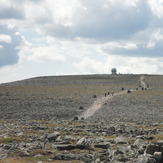
Eole trail

