– Lat/Long: 48.98° N 65.97° W
 Mont Jacques-Cartier
Weather Forecast, CanadaIssued: 1 pm Mon 31 Mar Local TimeUpdates in: hr min sUpdate imminent
Mont Jacques-Cartier Weather Forecast, Canada
Issued: 1 pm Mon 31 Mar Local Time
Updates in:
Update imminent hr min s

Issued: 1 pm Mon 31 Mar Local Time
Updates in:
Update imminent hr min s
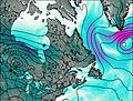
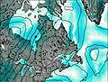
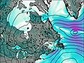
Days 1–4 Weather SummaryA moderate fall of snow, heaviest on Mon afternoon. Freeze-thaw conditions (max 4°C on Mon night, min -15°C on Tue night). Winds decreasing (near gales from the WNW on Tue afternoon, calm by Wed night). | Days 5–7 Weather SummaryA moderate fall of snow, heaviest on Thu afternoon. Temperatures will be below freezing (max -1°C on Thu night, min -7°C on Fri night). Winds decreasing (fresh winds from the S on Thu afternoon, calm by Fri night). | Days 8–10 Weather SummaryA moderate fall of snow, heaviest on Tue night. Freeze-thaw conditions (max 1°C on Sun afternoon, min -10°C on Mon night). Winds increasing (light winds from the WSW on Sun afternoon, strong winds from the W by Tue afternoon). | Days 11–13 Weather SummaryA moderate fall of snow, heaviest on Wed night. Freeze-thaw conditions (max 2°C on Fri afternoon, min -9°C on Wed night). Winds decreasing (strong winds from the NW on Wed night, calm by Fri afternoon). | |||||||||||||||||||||||||||||||||
Mon 31 | Tuesday 1 | Wednesday 2 | Thursday 3 | Friday 4 | Saturday 5 | Sunday 6 | Monday 7 | Tuesday 8 | Wednesday 9 | Thursday 10 | Friday 11 | Sat 12 | ||||||||||||||||||||||||
PM | night | AM | PM | night | AM | PM | night | AM | PM | night | AM | PM | night | AM | PM | night | AM | PM | night | AM | PM | night | AM | PM | night | AM | PM | night | AM | PM | night | AM | PM | night | AM | |
mod. snow | light rain | cloudy | cloudy | mod. snow | snow shwrs | some clouds | cloudy | light snow | light snow | light snow | light snow | cloudy | some clouds | some clouds | cloudy | cloudy | light snow | cloudy | snow shwrs | some clouds | clear | some clouds | light snow | light snow | mod. snow | light snow | light snow | heavy snow | light snow | cloudy | some clouds | some clouds | cloudy | some clouds | clear | |
km/h | ||||||||||||||||||||||||||||||||||||
 |  |  |  |  |  |  |  |  |  |  |  |  | ||||||||||||||||||||||||
8 | — | — | — | 6 | 1.0 | — | — | 3 | 4 | 3 | 2.0 | — | — | — | — | — | 2.0 | — | 2.0 | — | — | — | 1.0 | 2.0 | 9 | 3 | 3 | 12 | 1.0 | — | — | — | — | — | — | |
— | 0.9 | — | — | — | — | — | — | — | — | — | — | — | — | — | — | — | — | — | — | — | — | — | — | — | — | — | — | — | — | — | — | — | — | — | — | |
max°C | 0 | 4 | -1 | -5 | -9 | -13 | -10 | -10 | -6 | -3 | -1 | -1 | -2 | -6 | -1 | -1 | -2 | -1 | 1 | -3 | -5 | -5 | -9 | -9 | -8 | -6 | -8 | -8 | -9 | -6 | -4 | -4 | 0 | 2 | -2 | 1 |
min°C | -3 | 2 | -4 | -6 | -15 | -15 | -12 | -12 | -9 | -5 | -2 | -1 | -3 | -7 | -2 | -1 | -4 | -3 | 0 | -9 | -7 | -5 | -10 | -9 | -9 | -8 | -8 | -8 | -9 | -9 | -5 | -7 | -2 | 1 | -5 | 0 |
-10 | -4 | -12 | -16 | -27 | -26 | -22 | -17 | -16 | -13 | -8 | -6 | -8 | -11 | -2 | -5 | -10 | -10 | -5 | -18 | -14 | -13 | -18 | -17 | -20 | -17 | -16 | -18 | -19 | -17 | -11 | -11 | -4 | 1 | -8 | -4 | |
250 | 1450 | 0 | 0 | 0 | 0 | 0 | 0 | 0 | 0 | 200 | 300 | 0 | 0 | 350 | 300 | 0 | 300 | 550 | 0 | 0 | 0 | 0 | 0 | 0 | 0 | 0 | 0 | 0 | 0 | 0 | 0 | 600 | 700 | 0 | 800 | |
Cloud base (m) | 400 | 400 | 400 | 450 | 500 | 500 | 550 | 500 | 600 | 450 | 450 | 500 | 500 | 500 | 500 | 500 | 700 | 450 | 450 | 450 | 500 | 550 | 450 | 450 | 450 | 450 | 450 | 450 | 450 | 500 | 500 | 500 | 500 | 500 | 6650 | 500 |
— | — | 6:01 | — | — | 6:00 | — | — | 5:58 | — | — | 5:56 | — | — | 5:54 | — | — | 5:52 | — | — | 5:48 | — | — | 5:47 | — | — | 5:45 | — | — | 5:43 | — | — | 5:41 | — | — | 5:39 | |
6:52 | — | — | 6:53 | — | — | 6:54 | — | — | 6:57 | — | — | 6:58 | — | — | 7:00 | — | — | 7:00 | — | — | 7:02 | — | — | 7:04 | — | — | 7:06 | — | — | 7:07 | — | — | 7:08 | — | — | |
Mont Jacques-Cartier Weather (Days 0-3):
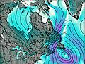
The weather forecast for Mont Jacques-Cartier is: A moderate fall of snow, heaviest on Mon afternoon. Freeze-thaw conditions (max 4°C on Mon night, min -15°C on Tue night). Winds decreasing (near gales from the WNW on Tue afternoon, calm by Wed night).
Mont Jacques-Cartier Weather (Days 3-6):
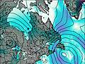
A moderate fall of snow, heaviest on Thu afternoon. Temperatures will be below freezing (max -1°C on Thu night, min -7°C on Fri night). Winds decreasing (fresh winds from the S on Thu afternoon, calm by Fri night).
Mont Jacques-Cartier Weather (Days 6-9):
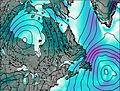
A moderate fall of snow, heaviest on Tue night. Freeze-thaw conditions (max 1°C on Sun afternoon, min -10°C on Mon night). Winds increasing (light winds from the WSW on Sun afternoon, strong winds from the W by Tue afternoon).
This table gives the weather forecast for Mont Jacques-Cartier at the specific elevation of 500 m. Our advanced weather models allow us to provide distinct weather forecasts for several elevations of Mont Jacques-Cartier. To see the weather forecasts for the other elevations, use the tab navigation above the table. For a wider overview of the weather, consult the Weather Map of Quebec.
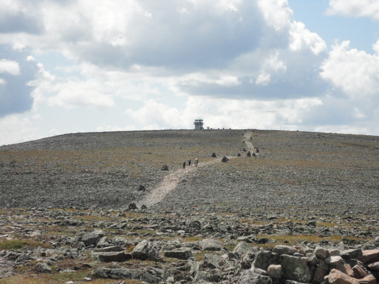
Mont Jacques-Cartier Photos
View all
Chic-Choc Mountains photos (7) |
Appalachians photos (859) |
photos from mountains in Canada (440) |
all photos
 Upload new photo
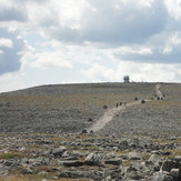
Eole trail

