– Lat/Long: 41.79° N 2.40° E
 Montseny
Weather Forecast, SpainIssued: 1 pm Thu 24 Apr Local TimeUpdates in: hr min sUpdate imminent
Montseny Weather Forecast, Spain
Issued: 1 pm Thu 24 Apr Local Time
Updates in:
Update imminent hr min s

Issued: 1 pm Thu 24 Apr Local Time
Updates in:
Update imminent hr min s
Days 1–4 Weather SummaryHeavy rain (total 25mm), heaviest during Sat night. Very mild (max 10°C on Fri afternoon, min 3°C on Sat night). Wind will be generally light. | Days 5–7 Weather SummaryLight rain (total 3mm), mostly falling on Sun afternoon. Mild temperatures (max 8°C on Tue afternoon, min 4°C on Sun afternoon). Wind will be generally light. | ||||||||||||||||
Thu 24 | Friday 25 | Saturday 26 | Sunday 27 | Monday 28 | Tuesday 29 | ||||||||||||
PM | night | AM | PM | night | AM | PM | night | AM | PM | night | AM | PM | night | AM | PM | night | |
some clouds | clear | clear | clear | rain shwrs | rain shwrs | light rain | rain shwrs | rain shwrs | rain shwrs | rain shwrs | clear | rain shwrs | rain shwrs | clear | clear | clear | |
km/h | |||||||||||||||||
 |  |  |  |  |  | ||||||||||||
— | — | — | — | — | — | — | — | — | — | — | — | — | — | — | — | — | |
— | — | — | — | 0.9 | 0.3 | 5 | 19 | 0.3 | 2 | 0.6 | — | 0.1 | 0.2 | — | — | — | |
max°C | 8 | 9 | 8 | 10 | 10 | 7 | 5 | 4 | 4 | 5 | 6 | 5 | 6 | 6 | 6 | 8 | 8 |
min°C | 7 | 8 | 8 | 8 | 8 | 6 | 5 | 3 | 3 | 4 | 4 | 5 | 6 | 6 | 6 | 7 | 7 |
4 | 6 | 7 | 8 | 7 | 4 | 2 | -2 | 3 | 2 | -1 | 2 | 6 | 4 | 3 | 5 | 4 | |
3750 | 3650 | 3550 | 3550 | 3350 | 2950 | 2650 | 2350 | 2200 | 2400 | 2600 | 2550 | 2700 | 2800 | 2800 | 3050 | 3300 | |
Cloud base (m) | 1550 | 700 | 500 | 800 | 7150 | 1600 | 450 | 500 | 2300 | 850 | 1950 | 2350 | 1750 | 2100 | |||
— | — | 6:56 | — | — | 6:54 | — | — | 6:52 | — | — | 6:50 | — | — | 6:50 | — | — | |
— | 8:39 | — | — | 8:40 | — | — | 8:42 | — | — | 8:43 | — | — | 8:44 | — | — | 8:45 | |
Loading...
Montseny Weather (Days 0-3):
The weather forecast for Montseny is: Heavy rain (total 25mm), heaviest during Sat night. Very mild (max 10°C on Fri afternoon, min 3°C on Sat night). Wind will be generally light.
Montseny Weather (Days 3-6):
Light rain (total 3mm), mostly falling on Sun afternoon. Mild temperatures (max 8°C on Tue afternoon, min 4°C on Sun afternoon). Wind will be generally light.
This table gives the weather forecast for Montseny at the specific elevation of 1706 m. Our advanced weather models allow us to provide distinct weather forecasts for several elevations of Montseny. To see the weather forecasts for the other elevations, use the tab navigation above the table. For a wider overview of the weather, consult the Weather Map of Spain.
| Weather Station | Temp. | Weather | Wind | Gusts | Cloud / Visibility |
|---|---|---|---|---|---|
GironaCostaBrava | |||||
Sabadell Airport | |||||
* NOTE: not all weather observatories update at the same frequency which is the reason why some locations may show data from stations that are further away than known closer ones.
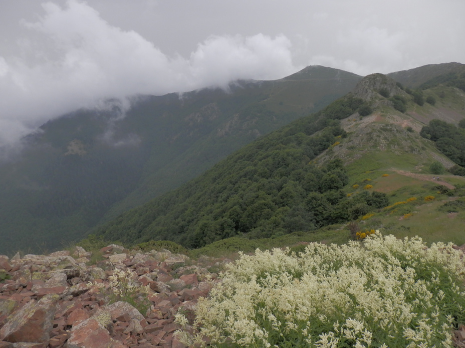
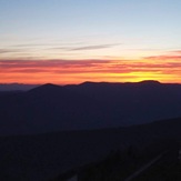
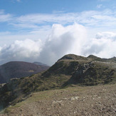
Montseny Photos
View all
photos (95) |
Pyrenees photos (134) |
photos from mountains in Spain (434) |
all photos
 Upload new photo
Turó de l'Home from Les Agudes
Turo de l'home sunset
Montseny

