– Lat/Long: 43.33° N 42.45° E

RsMount Elbrus – Climbing, Hiking & Mountaineering information

Placeholder

Mount Elbrus mountain guide

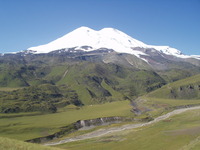
ELBRUS PEAK 5642 m., Mount Elbrus photo

Mount Elbrus

Photo credit: nazan ozhan

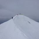
Warming Sunrise, Mount Elbrus photo

Mount Elbrus

Photo credit: CKlife_style

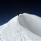
ELBRUS PEAK 5642 m., Mount Elbrus photo

Mount Elbrus

Photo credit: Nazan ÖZHAN

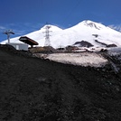
ELBRUS PEAK 5642 m., Mount Elbrus photo

Mount Elbrus

Photo credit: nazan özhan

  • Elevation: 5642 m
  • Difficulty: Basic Snow and Ice Climb
  • Best months to climb: June, July, August, September
  • Convenient center: Mineral'nye Vody, Russia

Mount Elbrus Climbing Notes

Joel from UNITED STATES writes:

Can you tell me what the weather is like for the north side of Elbrus in July and August at the base and high camp areas?

Joel, the info you require is at snow-forecast. You can see detailed hindcasts for different elevations of Elbrus for recent years but this part of snow-forecast.com is for members only.

Assuming you are not a member of that site, I can't create a free login unless you provide a valid email address. Note that this info is only available for a handful of mountains that are not at ski resorts.

For Elbrus, you are in luck.

Best wishes,
Rob Davies

2012-10-26

Click here to read 3 more climbing notes for Mount Elbrus or submit your own

Mount Elbrus Location Map

Select Mount Elbrus Location Map Detail:


Latest Gallery Images for Mount Elbrus

visit the
gallery
or click to view
Mount ElbrusElbrus dağı.mount Elbrus Elbrus dağı.

Upload your photo of Mount Elbrus

Select a mountain summit from the menu
Select a Mountain Summit
Surf breaks located close to Mount Elbrus Mountain peaks around Mount Elbrus Roads and rivers around Mount Elbrus

Use this relief map to navigate to mountain peaks in the area of Mount Elbrus.

10 other mountain peaks closest to Mount Elbrus:

1. Terskol (3900 m) 6.3 km
2. Ushba (4710 m) 28.1 km
3. Chatini (4412 m) 33.5 km
4. Latsga (4019 m) 33.9 km
5. Tetnuldi (4853 m) 55.2 km
6. Dzhangi-Tau (5051 m) 60.2 km
7. Dombai-Ulgen (4046 m) 60.4 km
8. Dykh-Tau (5204 m) 63.6 km
9. Shkhara (5200 m) 65.1 km
10. Gistola (4860 m) 68.7 km