
– Lat/Long: 49.77° N 125.74° W
 Mount Haig-Brown
Weather Forecast, CanadaIssued: 4 pm Tue 01 Apr Local TimeUpdates in: hr min sUpdate imminent
Mount Haig-Brown Weather Forecast, Canada
Issued: 4 pm Tue 01 Apr Local Time
Updates in:
Update imminent hr min s

Issued: 4 pm Tue 01 Apr Local Time
Updates in:
Update imminent hr min s
Days 1–4 Weather SummaryLight rain (total 2mm) at first, then becoming colder with a dusting of snow on Wed morning. Freeze-thaw conditions (max 7°C on Thu afternoon, min 0°C on Tue night). Wind will be generally light. | Days 5–7 Weather SummaryModerate rain (total 16mm) heaviest on Sun afternoon, then becoming colder with a dusting of snow on Sun night. Freeze-thaw conditions (max 9°C on Fri afternoon, min 0°C on Sun night). Wind will be generally light. | Days 8–10 Weather SummaryA heavy fall of snow, heaviest during Tue night. Becoming milder with heavy rain (total 93mm) on Thu morning. Freeze-thaw conditions (max 4°C on Wed night, min 0°C on Mon night). Wind will be generally light. | Days 11–13 Weather SummaryModerate rain (total 18mm) heaviest on Sat morning, then becoming colder with a dusting of snow on Sat night. Freeze-thaw conditions (max 9°C on Fri night, min 0°C on Thu night). Wind will be generally light. | |||||||||||||||||||||||||||||||||
Tue 1 | Wednesday 2 | Thursday 3 | Friday 4 | Saturday 5 | Sunday 6 | Monday 7 | Tuesday 8 | Wednesday 9 | Thursday 10 | Friday 11 | Saturday 12 | Sun 13 | ||||||||||||||||||||||||
PM | night | AM | PM | night | AM | PM | night | AM | PM | night | AM | PM | night | AM | PM | night | AM | PM | night | AM | PM | night | AM | PM | night | AM | PM | night | AM | PM | night | AM | PM | night | AM | |
rain shwrs | light rain | snow shwrs | rain shwrs | rain shwrs | clear | rain shwrs | rain shwrs | some clouds | cloudy | cloudy | some clouds | cloudy | light rain | mod. rain | mod. rain | light snow | light snow | light snow | mod. snow | mod. snow | light snow | mod. snow | light snow | heavy rain | heavy rain | heavy rain | light rain | some clouds | cloudy | light rain | rain shwrs | mod. rain | mod. rain | light snow | snow shwrs | |
km/h | ||||||||||||||||||||||||||||||||||||
 |  |  |  |  |  |  |  |  |  |  |  |  | ||||||||||||||||||||||||
— | — | 1.0 | — | — | — | — | — | — | — | — | — | — | — | — | — | 2.0 | 1.0 | 1.0 | 6 | 6 | 2.0 | 8 | 4 | — | — | — | — | — | — | — | — | — | — | 2.0 | 1.0 | |
0.7 | 0.7 | — | 0.4 | 0.1 | — | 0.1 | 0.1 | — | — | — | — | — | 1.4 | 5 | 7 | 2 | — | — | — | — | — | — | — | 22 | 39 | 32 | 2.0 | — | — | 0.1 | 0.5 | 8 | 6 | 1.2 | — | |
max°C | 4 | 2 | 1 | 3 | 2 | 4 | 7 | 5 | 5 | 9 | 7 | 7 | 9 | 6 | 3 | 3 | 2 | 0 | 1 | 1 | 1 | 2 | 1 | 2 | 3 | 4 | 3 | 3 | 2 | 2 | 5 | 9 | 8 | 5 | 4 | 1 |
min°C | 4 | 0 | 0 | 2 | 1 | 2 | 6 | 3 | 4 | 8 | 5 | 6 | 9 | 3 | 3 | 3 | 0 | 0 | 1 | 0 | 0 | 1 | 1 | 2 | 2 | 3 | 2 | 3 | 0 | 1 | 4 | 5 | 6 | 5 | 1 | 1 |
3 | 0 | 0 | 2 | 1 | 2 | 6 | 3 | 4 | 8 | 4 | 5 | 8 | 1 | 1 | 1 | -3 | -2 | -1 | -3 | -3 | -3 | -2 | 0 | -1 | 0 | -1 | 0 | 0 | -1 | 2 | 3 | 5 | 2 | -2 | -3 | |
1450 | 1150 | 1100 | 1400 | 1250 | 1500 | 2000 | 2000 | 2100 | 2700 | 2550 | 2350 | 2550 | 1750 | 1500 | 1450 | 1100 | 1050 | 1150 | 1150 | 1250 | 1200 | 1200 | 1350 | 1650 | 1950 | 1600 | 1450 | 1150 | 1300 | 2200 | 2900 | 2100 | 1700 | 1250 | 1150 | |
Cloud base (m) | 1500 | 700 | 700 | 750 | 900 | 800 | 2050 | 1650 | 1600 | 1950 | 850 | 5650 | 2900 | 950 | 700 | 700 | 700 | 700 | 700 | 700 | 700 | 700 | 700 | 700 | 700 | 700 | 700 | 750 | 850 | 700 | 700 | 4950 | 700 | 700 | 650 | 650 |
— | — | 6:58 | — | — | 6:56 | — | — | 6:54 | — | — | 6:50 | — | — | 6:48 | — | — | 6:47 | — | — | 6:45 | — | — | 6:43 | — | — | 6:41 | — | — | 6:39 | — | — | 6:37 | — | — | 6:35 | |
7:53 | — | — | 7:54 | — | — | 7:57 | — | — | 7:58 | — | — | — | 8:00 | — | — | 8:01 | — | — | 8:02 | — | — | 8:05 | — | — | 8:06 | — | — | 8:07 | — | — | 8:08 | — | — | 8:10 | — | |
Mount Haig-Brown Weather (Days 0-3):
The weather forecast for Mount Haig-Brown is: Light rain (total 2mm) at first, then becoming colder with a dusting of snow on Wed morning. Freeze-thaw conditions (max 7°C on Thu afternoon, min 0°C on Tue night). Wind will be generally light.
Mount Haig-Brown Weather (Days 3-6):
Moderate rain (total 16mm) heaviest on Sun afternoon, then becoming colder with a dusting of snow on Sun night. Freeze-thaw conditions (max 9°C on Fri afternoon, min 0°C on Sun night). Wind will be generally light.
Mount Haig-Brown Weather (Days 6-9):
A heavy fall of snow, heaviest during Tue night. Becoming milder with heavy rain (total 93mm) on Thu morning. Freeze-thaw conditions (max 4°C on Wed night, min 0°C on Mon night). Wind will be generally light.
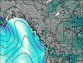
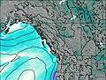
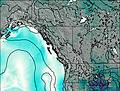
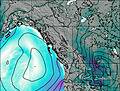
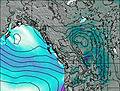
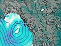
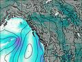
This table gives the weather forecast for Mount Haig-Brown at the specific elevation of 1000 m. Our advanced weather models allow us to provide distinct weather forecasts for several elevations of Mount Haig-Brown. To see the weather forecasts for the other elevations, use the tab navigation above the table. For a wider overview of the weather, consult the Weather Map of British-Columbia.
| Weather Station | Temp. | Weather | Wind | Gusts | Cloud / Visibility |
|---|---|---|---|---|---|
Campbell River Airport | |||||
SHIP316 | |||||
Sentry Shoal Buoy | |||||
Comox Millitary Base Airport | |||||
Cfb - Comox- BC | |||||
Cfb - Comox- BC | |||||
Estevan Point Airport |
* NOTE: not all weather observatories update at the same frequency which is the reason why some locations may show data from stations that are further away than known closer ones.

