
– Lat/Long: 49.77° N 125.74° W
 Mount Haig-Brown
Weather Forecast, CanadaIssued: 4 pm Mon 21 Apr Local TimeUpdates in: hr min sUpdate imminent
Mount Haig-Brown Weather Forecast, Canada
Issued: 4 pm Mon 21 Apr Local Time
Updates in:
Update imminent hr min s

Issued: 4 pm Mon 21 Apr Local Time
Updates in:
Update imminent hr min s
Days 1–4 Weather SummaryMostly dry. Freeze-thaw conditions (max 1°C on Wed afternoon, min -4°C on Mon night). Wind will be generally light. | Days 5–7 Weather SummaryA dusting of new snow. Freeze-thaw conditions (max 4°C on Thu afternoon, min -5°C on Sun morning). Wind will be generally light. | ||||||||||||||||
Mon 21 | Tuesday 22 | Wednesday 23 | Thursday 24 | Friday 25 | Saturday 26 | ||||||||||||
PM | night | AM | PM | night | AM | PM | night | AM | PM | night | AM | PM | night | AM | PM | night | |
some clouds | clear | clear | some clouds | some clouds | clear | cloudy | clear | clear | some clouds | some clouds | cloudy | light snow | light snow | cloudy | some clouds | some clouds | |
km/h | |||||||||||||||||
 |  |  |  |  |  | ||||||||||||
— | — | — | — | — | — | — | — | — | — | — | — | 1.0 | 2.0 | — | — | — | |
— | — | — | — | — | — | — | — | — | — | — | — | — | — | — | — | — | |
max°C | -2 | -3 | -3 | -1 | -1 | -1 | 1 | 1 | 1 | 4 | 3 | 1 | 1 | 0 | -1 | 0 | -1 |
min°C | -3 | -4 | -4 | -1 | -2 | -2 | 1 | 0 | 0 | 3 | 2 | 1 | 1 | -1 | -2 | 0 | -4 |
-6 | -9 | -8 | -4 | -6 | -2 | 1 | -2 | -3 | 0 | -2 | -3 | -3 | -4 | -5 | -3 | -9 | |
1700 | 1200 | 1500 | 1900 | 1550 | 1800 | 2050 | 2050 | 2100 | 2350 | 2250 | 2100 | 2100 | 1950 | 1650 | 1950 | 1350 | |
Cloud base (m) | 2650 | 850 | 800 | 2250 | 1900 | 1650 | 2200 | 1900 | 2950 | 2700 | 2450 | 850 | 700 | 700 | 1550 | 2050 | |
— | — | 6:16 | — | — | 6:15 | — | — | 6:13 | — | — | 6:11 | — | — | 6:09 | — | — | |
— | 8:24 | — | — | 8:25 | — | — | 8:28 | — | — | 8:29 | — | — | 8:30 | — | — | 8:32 | |
Loading...
Mount Haig-Brown Weather (Days 0-3):
The weather forecast for Mount Haig-Brown is: Mostly dry. Freeze-thaw conditions (max 1°C on Wed afternoon, min -4°C on Mon night). Wind will be generally light.
Mount Haig-Brown Weather (Days 3-6):
A dusting of new snow. Freeze-thaw conditions (max 4°C on Thu afternoon, min -5°C on Sun morning). Wind will be generally light.
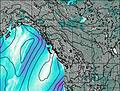
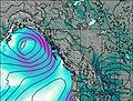
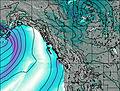
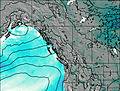
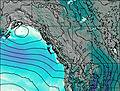
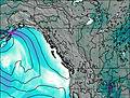
This table gives the weather forecast for Mount Haig-Brown at the specific elevation of 1948 m. Our advanced weather models allow us to provide distinct weather forecasts for several elevations of Mount Haig-Brown. To see the weather forecasts for the other elevations, use the tab navigation above the table. For a wider overview of the weather, consult the Weather Map of British-Columbia.
| Weather Station | Temp. | Weather | Wind | Gusts | Cloud / Visibility |
|---|---|---|---|---|---|
Campbell River Airport | |||||
SHIP284 | |||||
Sentry Shoal Buoy | |||||
Comox Millitary Base Airport | |||||
Comox Millitary Base Airport | |||||
Estevan Point Airport | |||||
* NOTE: not all weather observatories update at the same frequency which is the reason why some locations may show data from stations that are further away than known closer ones.

