– Lat/Long: 49.83° N 122.97° W
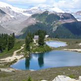
 Opal Cone
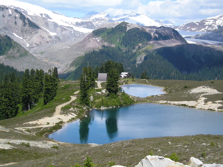
Weather Forecast, CanadaIssued: 10 pm Tue 01 Apr Local TimeUpdates in: hr min sUpdate imminent
Opal Cone Weather Forecast, Canada
Issued: 10 pm Tue 01 Apr Local Time
Updates in:
Update imminent hr min s

Issued: 10 pm Tue 01 Apr Local Time
Updates in:
Update imminent hr min s
Days 1–4 Weather SummaryA dusting of new snow. Freeze-thaw conditions (max 9°C on Fri afternoon, min 0°C on Wed morning). Wind will be generally light. | Days 5–7 Weather SummaryModerate rain (total 18mm), heaviest on Sun afternoon giving way to a moderate fall of snow, heaviest on Sun night. Freeze-thaw conditions (max 9°C on Sat afternoon, min 0°C on Sun night). Wind will be generally light. | Days 8–10 Weather SummaryA dusting of snow. Milder later with heavy rain (total 125mm) on Wed night. Freeze-thaw conditions (max 6°C on Wed afternoon, min 0°C on Mon night). Wind will be generally light. | Days 11–13 Weather SummaryLight rain (total 5mm), mostly falling on Sat afternoon. Freeze-thaw conditions (max 6°C on Sun afternoon, min 0°C on Sat night). Wind will be generally light. | |||||||||||||||||||||||||||||||||
Wednesday 2 | Thursday 3 | Friday 4 | Saturday 5 | Sunday 6 | Monday 7 | Tuesday 8 | Wednesday 9 | Thursday 10 | Friday 11 | Saturday 12 | Sun 13 | |||||||||||||||||||||||||
night | AM | PM | night | AM | PM | night | AM | PM | night | AM | PM | night | AM | PM | night | AM | PM | night | AM | PM | night | AM | PM | night | AM | PM | night | AM | PM | night | AM | PM | night | AM | PM | |
light snow | light snow | some clouds | some clouds | some clouds | some clouds | some clouds | some clouds | some clouds | some clouds | cloudy | some clouds | light rain | light rain | heavy rain | mod. snow | light snow | mod. snow | light snow | cloudy | light rain | heavy rain | heavy rain | heavy rain | heavy rain | rain shwrs | rain shwrs | rain shwrs | some clouds | light rain | light rain | rain shwrs | risk tstorm | rain shwrs | clear | clear | |
km/h | ||||||||||||||||||||||||||||||||||||
 |  |  |  |  |  |  |  |  |  |  |  |  | ||||||||||||||||||||||||
1.0 | 2.0 | — | — | — | — | — | — | — | — | — | — | — | — | — | 8 | 1.0 | 7 | 2.0 | — | — | — | — | — | — | — | — | — | — | — | — | — | — | — | — | — | |
0.8 | — | — | — | — | — | — | — | — | — | — | — | 0.2 | 2 | 11 | 5 | — | — | — | — | 1.7 | 38 | 26 | 28 | 31 | 0.3 | 0.2 | 0.1 | — | 0.7 | 0.7 | 0.4 | 2 | 0.2 | — | — | |
max°C | 2 | 1 | 2 | 1 | 3 | 6 | 4 | 5 | 9 | 6 | 8 | 9 | 7 | 5 | 4 | 4 | 1 | 2 | 1 | 1 | 3 | 3 | 4 | 6 | 6 | 3 | 5 | 3 | 4 | 5 | 3 | 2 | 4 | 2 | 4 | 6 |
min°C | 1 | 0 | 2 | 0 | 0 | 5 | 3 | 3 | 8 | 6 | 6 | 9 | 5 | 5 | 4 | 0 | 0 | 2 | 0 | 0 | 2 | 2 | 3 | 5 | 3 | 2 | 4 | 1 | 3 | 4 | 2 | 1 | 4 | 0 | 1 | 6 |
-1 | 0 | 1 | 0 | 0 | 5 | 3 | 3 | 8 | 5 | 5 | 8 | 3 | 3 | 2 | -3 | -3 | -1 | -3 | -3 | -1 | -1 | 0 | 2 | 0 | 1 | 4 | 1 | 3 | 4 | 2 | 1 | 3 | 0 | 1 | 6 | |
1150 | 1150 | 1250 | 1000 | 1400 | 1800 | 1650 | 1900 | 2450 | 2350 | 2250 | 2250 | 2200 | 1950 | 1650 | 1200 | 1150 | 1250 | 1100 | 1150 | 1400 | 1500 | 1800 | 2050 | 1550 | 1450 | 1650 | 1450 | 1600 | 1600 | 1450 | 1300 | 1550 | 1200 | 1500 | 2150 | |
Cloud base (m) | 650 | 650 | 700 | 700 | 700 | 950 | 1650 | 1850 | 6300 | 5400 | 2750 | 2450 | 650 | 650 | 700 | 750 | 650 | 700 | 700 | 700 | 700 | 700 | 650 | 700 | 800 | 1600 | 1850 | 1550 | 1750 | 2000 | 750 | 1600 | 1550 | 850 | 2000 | |
— | 6:47 | — | — | 6:45 | — | — | 6:41 | — | — | 6:39 | — | — | 6:37 | — | — | 6:35 | — | — | 6:33 | — | — | 6:31 | — | — | 6:30 | — | — | 6:28 | — | — | 6:26 | — | — | 6:24 | — | |
— | — | 7:44 | — | — | 7:45 | — | — | 7:46 | — | — | 7:49 | — | — | 7:51 | — | — | 7:52 | — | — | 7:53 | — | — | 7:54 | — | — | 7:57 | — | — | 7:58 | — | — | — | 8:00 | — | 8:00 | |
Opal Cone Weather (Days 0-3):
The weather forecast for Opal Cone is: A dusting of new snow. Freeze-thaw conditions (max 9°C on Fri afternoon, min 0°C on Wed morning). Wind will be generally light.
Opal Cone Weather (Days 3-6):
Moderate rain (total 18mm), heaviest on Sun afternoon giving way to a moderate fall of snow, heaviest on Sun night. Freeze-thaw conditions (max 9°C on Sat afternoon, min 0°C on Sun night). Wind will be generally light.
Opal Cone Weather (Days 6-9):
A dusting of snow. Milder later with heavy rain (total 125mm) on Wed night. Freeze-thaw conditions (max 6°C on Wed afternoon, min 0°C on Mon night). Wind will be generally light.
This table gives the weather forecast for Opal Cone at the specific elevation of 1000 m. Our advanced weather models allow us to provide distinct weather forecasts for several elevations of Opal Cone. To see the weather forecasts for the other elevations, use the tab navigation above the table. For a wider overview of the weather, consult the Weather Map of British-Columbia.