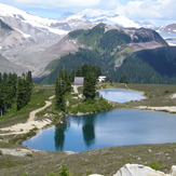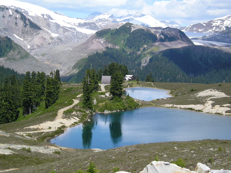
– Lat/Long: 49.83° N 122.97° W
 Opal Cone
Weather Forecast, CanadaIssued: 10 pm Thu 17 Apr Local TimeUpdates in: hr min sUpdate imminent
Opal Cone Weather Forecast, Canada
Issued: 10 pm Thu 17 Apr Local Time
Updates in:
Update imminent hr min s

Issued: 10 pm Thu 17 Apr Local Time
Updates in:
Update imminent hr min s
Days 1–4 Weather SummaryA dusting of new snow. Freeze-thaw conditions (max 6°C on Thu night, min -4°C on Sat night). Wind will be generally light. | Days 5–7 Weather SummaryMostly dry. Freeze-thaw conditions (max 5°C on Wed afternoon, min -5°C on Sun night). Wind will be generally light. | ||||||||||||||||||
Friday 18 | Saturday 19 | Sunday 20 | Monday 21 | Tuesday 22 | Wednesday 23 | ||||||||||||||
night | AM | PM | night | AM | PM | night | AM | PM | night | AM | PM | night | AM | PM | night | AM | PM | night | |
clear | clear | some clouds | some clouds | some clouds | some clouds | some clouds | light snow | light snow | some clouds | cloudy | cloudy | some clouds | some clouds | rain shwrs | clear | clear | some clouds | clear | |
km/h | |||||||||||||||||||
 |  |  |  |  |  |  | |||||||||||||
— | — | — | — | — | — | — | 2.0 | 2.0 | — | — | — | — | — | — | — | — | — | — | |
— | — | — | — | — | — | — | — | — | — | — | — | — | — | 0.1 | — | — | — | — | |
max°C | 6 | 5 | 6 | 3 | -1 | 0 | -2 | -4 | -4 | -4 | -4 | -2 | -3 | -1 | 2 | 1 | 3 | 5 | 4 |
min°C | 5 | 5 | 6 | 0 | -1 | -1 | -4 | -4 | -4 | -5 | -5 | -3 | -4 | -3 | 1 | 1 | 1 | 4 | 3 |
5 | 5 | 4 | -3 | -5 | -5 | -7 | -7 | -8 | -5 | -5 | -6 | -4 | -3 | 1 | 1 | 1 | 4 | 3 | |
3150 | 3400 | 2850 | 1900 | 1500 | 1650 | 1150 | 1150 | 1150 | 1000 | 1100 | 1400 | 1100 | 1550 | 1950 | 1850 | 2050 | 2300 | 2200 | |
Cloud base (m) | 9150 | 6150 | 1550 | 900 | 1750 | 750 | 700 | 700 | 700 | 700 | 800 | 1600 | 900 | 1950 | 2900 | ||||
— | 6:13 | — | — | 6:11 | — | — | 6:09 | — | — | 6:07 | — | — | 6:05 | — | — | 6:03 | — | — | |
— | — | — | 8:08 | — | — | 8:10 | — | — | 8:12 | — | — | 8:14 | — | — | 8:15 | — | — | 8:16 | |
Loading...
Opal Cone Weather (Days 0-3):
The weather forecast for Opal Cone is: A dusting of new snow. Freeze-thaw conditions (max 6°C on Thu night, min -4°C on Sat night). Wind will be generally light.
Opal Cone Weather (Days 3-6):
Mostly dry. Freeze-thaw conditions (max 5°C on Wed afternoon, min -5°C on Sun night). Wind will be generally light.
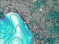
This table gives the weather forecast for Opal Cone at the specific elevation of 1736 m. Our advanced weather models allow us to provide distinct weather forecasts for several elevations of Opal Cone. To see the weather forecasts for the other elevations, use the tab navigation above the table. For a wider overview of the weather, consult the Weather Map of British-Columbia.
| Weather Station | Temp. | Weather | Wind | Gusts | Cloud / Visibility |
|---|---|---|---|---|---|
Squamish Airport- BC | |||||
Squamish Airport | |||||
Howe Sound - Pam Rocks- BC | |||||
Port Mellon- BC |
* NOTE: not all weather observatories update at the same frequency which is the reason why some locations may show data from stations that are further away than known closer ones.