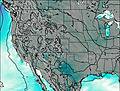
– Lat/Long: 38.94° N 104.91° W
 Petkash Peak
Weather Forecast, United StatesIssued: 5 pm Tue 01 Apr Local TimeUpdates in: hr min sUpdate imminent
Petkash Peak Weather Forecast, United States
Issued: 5 pm Tue 01 Apr Local Time
Updates in:
Update imminent hr min s

Issued: 5 pm Tue 01 Apr Local Time
Updates in:
Update imminent hr min s
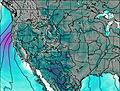
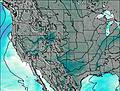
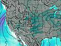
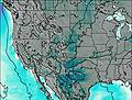
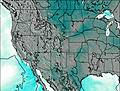
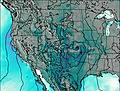
Days 1–4 Weather SummaryA moderate fall of snow, heaviest on Tue night. Freeze-thaw conditions (max 7°C on Tue afternoon, min -3°C on Tue night). Winds decreasing (fresh winds from the WNW on Wed morning, calm by Fri morning). | Days 5–7 Weather SummaryA dusting of new snow. Freeze-thaw conditions (max 10°C on Mon morning, min -5°C on Fri night). Wind will be generally light. | Days 8–10 Weather SummaryMostly dry. Very mild (max 16°C on Thu morning, min 6°C on Tue night). Winds increasing (calm on Mon afternoon, fresh winds from the WNW by Tue morning). | Days 11–13 Weather SummaryMostly dry. Warm (max 23°C on Sun afternoon, min 12°C on Thu night). Wind will be generally light. | |||||||||||||||||||||||||||||||||
Tue 1 | Wednesday 2 | Thursday 3 | Friday 4 | Saturday 5 | Sunday 6 | Monday 7 | Tuesday 8 | Wednesday 9 | Thursday 10 | Friday 11 | Saturday 12 | Sun 13 | ||||||||||||||||||||||||
PM | night | AM | PM | night | AM | PM | night | AM | PM | night | AM | PM | night | AM | PM | night | AM | PM | night | AM | PM | night | AM | PM | night | AM | PM | night | AM | PM | night | AM | PM | night | AM | |
light rain | snow shwrs | some clouds | cloudy | cloudy | light snow | light snow | light snow | some clouds | light snow | light snow | cloudy | some clouds | some clouds | some clouds | rain shwrs | clear | clear | some clouds | some clouds | some clouds | some clouds | clear | clear | some clouds | clear | clear | clear | clear | clear | some clouds | some clouds | cloudy | some clouds | rain shwrs | some clouds | |
km/h | ||||||||||||||||||||||||||||||||||||
 |  |  |  |  |  |  |  |  |  |  |  |  | ||||||||||||||||||||||||
— | 3 | — | — | — | 1.0 | 5 | 1.0 | — | 2.0 | 2.0 | — | — | — | — | — | — | — | — | — | — | — | — | — | — | — | — | — | — | — | — | — | — | — | — | — | |
0.7 | — | — | — | — | — | — | — | — | — | — | — | — | — | — | 0.1 | — | — | — | — | — | — | — | — | — | — | — | — | — | — | — | — | — | — | 0.1 | — | |
max°C | 7 | 1 | 1 | 3 | 0 | -1 | 0 | -2 | 0 | 0 | -1 | -2 | 1 | -1 | 6 | 8 | 4 | 10 | 12 | 9 | 13 | 13 | 8 | 12 | 15 | 12 | 16 | 18 | 14 | 18 | 20 | 17 | 20 | 22 | 17 | 21 |
min°C | 4 | -3 | -1 | 3 | -1 | -2 | 0 | -3 | 0 | 0 | -5 | -4 | 0 | -2 | 3 | 7 | 3 | 7 | 12 | 7 | 9 | 12 | 6 | 9 | 15 | 10 | 13 | 17 | 12 | 16 | 19 | 14 | 17 | 20 | 15 | 19 |
-1 | -10 | -8 | -3 | -5 | -6 | -4 | -5 | 0 | -4 | -11 | -9 | -3 | -5 | 1 | 5 | -1 | 4 | 11 | 4 | 6 | 10 | 3 | 7 | 15 | 9 | 13 | 17 | 11 | 16 | 19 | 14 | 17 | 20 | 14 | 19 | |
2950 | 1850 | 1800 | 2400 | 1950 | 1700 | 2050 | 1600 | 2000 | 2000 | 1700 | 1350 | 2100 | 1550 | 2500 | 3050 | 3000 | 2950 | 3550 | 3450 | 3350 | 3600 | 3200 | 3300 | 3850 | 3900 | 3850 | 4150 | 4000 | 4100 | 4450 | 4300 | 4350 | 4550 | 4400 | 4450 | |
Cloud base (m) | 2600 | 5850 | 5000 | 5200 | 2700 | 2600 | 2600 | 2600 | 2600 | 2600 | 2600 | 2700 | 2950 | 5250 | 4900 | 4750 | 8550 | 4900 | 5800 | 9200 | 5800 | 5250 | 7150 | 6350 | 5400 | |||||||||||
— | — | 6:43 | — | — | 6:41 | — | — | 6:39 | — | — | 6:37 | — | — | 6:37 | — | — | 6:35 | — | — | 6:33 | — | — | 6:31 | — | — | 6:31 | — | — | 6:28 | — | — | 6:28 | — | — | 6:26 | |
7:22 | — | — | 7:22 | — | — | 7:23 | — | — | 7:24 | — | — | 7:25 | — | — | 7:27 | — | — | 7:28 | — | — | 7:29 | — | — | 7:30 | — | — | 7:30 | — | — | 7:31 | — | — | 7:32 | — | — | |
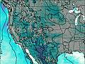
Petkash Peak Weather (Days 0-3):
The weather forecast for Petkash Peak is: A moderate fall of snow, heaviest on Tue night. Freeze-thaw conditions (max 7°C on Tue afternoon, min -3°C on Tue night). Winds decreasing (fresh winds from the WNW on Wed morning, calm by Fri morning).
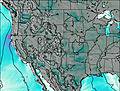
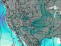
Petkash Peak Weather (Days 3-6):
A dusting of new snow. Freeze-thaw conditions (max 10°C on Mon morning, min -5°C on Fri night). Wind will be generally light.
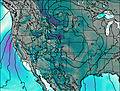
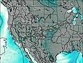
Petkash Peak Weather (Days 6-9):
Mostly dry. Very mild (max 16°C on Thu morning, min 6°C on Tue night). Winds increasing (calm on Mon afternoon, fresh winds from the WNW by Tue morning).
This table gives the weather forecast for Petkash Peak at the specific elevation of 2000 m. Our advanced weather models allow us to provide distinct weather forecasts for several elevations of Petkash Peak. To see the weather forecasts for the other elevations, use the tab navigation above the table. For a wider overview of the weather, consult the Weather Map of Colorado.
| Weather Station | Temp. | Weather | Wind | Gusts | Cloud / Visibility |
|---|---|---|---|---|---|
Colorado Springs Airport | |||||
Cheyenne Mtn Airport | |||||
Fort Carson Airport | |||||
Schriever AFB | |||||
Monumen / lbert Mountain Airport | |||||
Wilkerson Pass |
* NOTE: not all weather observatories update at the same frequency which is the reason why some locations may show data from stations that are further away than known closer ones.
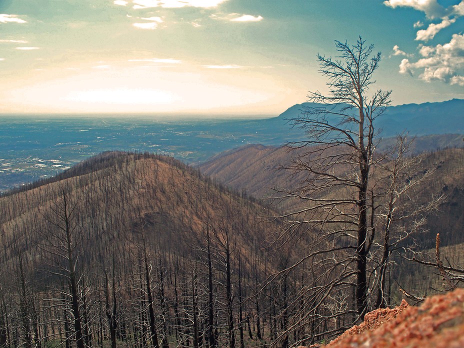
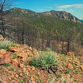
Petkash Peak Photos
View all
Front Range photos (84) |
Rocky Mountains (USA) photos (259) |
photos from mountains in United States (2877) |
all photos
 Upload new photo
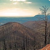
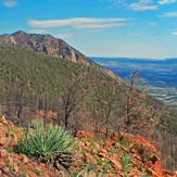
Petkash Peak Southview
Petkash Peak
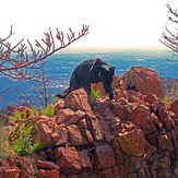
Petkash Peak Pano
Top of Petkash Peak

