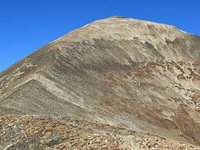
Quandary Peak guide
- Elevation: 4348 m
- Difficulty: Walk up
- Best months to climb: June, July, August, September
- Convenient center: Breckenridge
Quandary Peak Climbing Notes
Zack Weaver from UNITED STATES writes:
First of all, really pleased to find this website with totally accurate forecasts. Made the decision to go based on it and wasn’t disappointed.
1/9/18: Very little snow as the ski resorts are lamenting.
Good hard pack below the tree line and icy in the steep switchbacks above the trailhead. Micro-spikes are ideal.
At and above the tree line as far up as the exposed south-facing east ridge snowshoes came in handy for knee-deep spindrift. Snowshoes (or crampons) totally worth it on the last ~800 vertical feet which is hard packed snow and some ice and quite steep.
Gusty wind. Definitely recommend trekking poles for stability. Otherwise a fun and beautiful moderate level 14’er. 4.5 hours round trip.
Use this site to plan for conditions! It was spot on.
2018-01-10 |
Click here to read 3 more climbing notes for Quandary Peak or submit your own
|

Select Quandary Peak Location Map Detail:
Use this relief map to navigate to mountain peaks in the area of Quandary Peak.
10 other mountain peaks closest to Quandary Peak:


 Like us
 Follow us
 Follow us