– Lat/Long: 55.48° N 2.13° W
 The Cheviot
Weather Forecast, United KingdomIssued: 5 am Sat 29 Mar Local TimeUpdates in: hr min sUpdate imminent
The Cheviot Weather Forecast, United Kingdom
Issued: 5 am Sat 29 Mar Local Time
Updates in:
Update imminent hr min s

Issued: 5 am Sat 29 Mar Local Time
Updates in:
Update imminent hr min s
Days 1–3 Weather SummaryMostly dry. Very mild (max 14°C on Mon morning, min 5°C on Sun night). Winds decreasing (strong winds from the WSW on Sat afternoon, calm by Sun night). | Days 4–6 Weather SummaryMostly dry. Very mild (max 12°C on Tue morning, min 3°C on Tue night). Wind will be generally light. | Days 7–9 Weather SummarySome drizzle, heaviest during Sun afternoon. Very mild (max 16°C on Sat afternoon, min 5°C on Fri night). Wind will be generally light. | Days 10–12 Weather SummarySome drizzle, heaviest during Tue afternoon. Very mild (max 17°C on Mon afternoon, min 8°C on Wed night). Wind will be generally light. | |||||||||||||||||||||||||||||||||
Saturday 29 | Sunday 30 | Monday 31 | Tuesday 1 | Wednesday 2 | Thursday 3 | Friday 4 | Saturday 5 | Sunday 6 | Monday 7 | Tuesday 8 | Wednesday 9 | |||||||||||||||||||||||||
AM | PM | night | AM | PM | night | AM | PM | night | AM | PM | night | AM | PM | night | AM | PM | night | AM | PM | night | AM | PM | night | AM | PM | night | AM | PM | night | AM | PM | night | AM | PM | night | |
cloudy | light rain | rain shwrs | clear | clear | some clouds | some clouds | cloudy | some clouds | clear | clear | some clouds | clear | clear | clear | some clouds | clear | clear | clear | clear | some clouds | cloudy | cloudy | some clouds | some clouds | light rain | rain shwrs | cloudy | rain shwrs | some clouds | some clouds | rain shwrs | rain shwrs | light rain | rain shwrs | some clouds | |
km/h | ||||||||||||||||||||||||||||||||||||
 |  |  |  |  |  |  |  |  |  |  |  | |||||||||||||||||||||||||
— | — | — | — | — | — | — | — | — | — | — | — | — | — | — | — | — | — | — | — | — | — | — | — | — | — | — | — | — | — | — | — | — | — | — | — | |
— | 0.1 | 0.1 | — | — | — | — | — | — | — | — | — | — | — | — | — | — | — | — | — | — | — | — | — | — | 1.2 | 0.1 | — | 0.2 | — | — | 0.5 | 0.1 | 0.2 | 0.1 | — | |
max°C | 8 | 8 | 9 | 11 | 12 | 7 | 14 | 14 | 10 | 12 | 12 | 5 | 12 | 11 | 6 | 11 | 11 | 6 | 11 | 10 | 6 | 15 | 16 | 11 | 15 | 15 | 11 | 15 | 17 | 12 | 14 | 14 | 10 | 13 | 13 | 9 |
min°C | 7 | 8 | 7 | 9 | 9 | 5 | 10 | 13 | 7 | 10 | 8 | 3 | 8 | 9 | 5 | 9 | 8 | 4 | 8 | 8 | 5 | 9 | 13 | 9 | 13 | 11 | 9 | 12 | 15 | 10 | 13 | 12 | 9 | 12 | 12 | 8 |
3 | 3 | 2 | 5 | 8 | 2 | 9 | 12 | 5 | 8 | 6 | 1 | 7 | 8 | 5 | 9 | 7 | 4 | 6 | 6 | 3 | 8 | 13 | 9 | 13 | 10 | 9 | 12 | 15 | 10 | 13 | 11 | 8 | 12 | 10 | 7 | |
1050 | 1850 | 1150 | 1900 | 1400 | 2450 | 2000 | 2500 | 3000 | 3150 | 3200 | 3150 | 3000 | 2950 | 2800 | 2800 | 2750 | 2700 | 2450 | 2150 | 2350 | 2600 | 2550 | 2700 | 2600 | 2350 | 2250 | 2150 | 2150 | 2150 | 2100 | 2200 | 2250 | 2100 | 2100 | 1900 | |
Cloud base (m) | 650 | 1550 | 400 | 600 | 800 | 6600 | 900 | 850 | 6000 | 7900 | 6450 | 2100 | 1500 | 2100 | 2850 | 4550 | 1900 | 400 | 2400 | 900 | 2250 | 2250 | 750 | 750 | 1650 | 450 | 1700 | |||||||||
5:47 | — | — | 6:45 | — | — | 5:41 | — | — | 5:39 | — | — | 5:37 | — | — | 5:33 | — | — | 5:31 | — | — | 5:28 | — | — | 5:26 | — | — | 5:24 | — | — | 5:22 | — | — | 5:18 | — | — | |
— | 6:39 | — | — | 7:42 | — | — | 6:44 | — | — | 6:45 | — | — | 6:47 | — | — | 6:50 | — | — | 6:52 | — | — | 6:52 | — | — | 6:54 | — | — | 6:57 | — | — | 6:59 | — | — | 7:00 | — | |
The Cheviot Weather (Days 0-3):
The weather forecast for The Cheviot is: Mostly dry. Very mild (max 14°C on Mon morning, min 5°C on Sun night). Winds decreasing (strong winds from the WSW on Sat afternoon, calm by Sun night).
The Cheviot Weather (Days 3-6):
Mostly dry. Very mild (max 12°C on Tue morning, min 3°C on Tue night). Wind will be generally light.
The Cheviot Weather (Days 6-9):
Some drizzle, heaviest during Sun afternoon. Very mild (max 16°C on Sat afternoon, min 5°C on Fri night). Wind will be generally light.
This table gives the weather forecast for The Cheviot at the specific elevation of 133 m. Our advanced weather models allow us to provide distinct weather forecasts for several elevations of The Cheviot. To see the weather forecasts for the other elevations, use the tab navigation above the table. For a wider overview of the weather, consult the Weather Map of United Kingdom.
| Weather Station | Temp. | Weather | Wind | Gusts | Cloud / Visibility |
|---|---|---|---|---|---|
SEPA Eyemouth wave rider | |||||
Newbiggin Waverider | |||||
Witchieknowe | |||||
Spadeadam Airport | |||||
Torness Power Station Waverider | |||||
Newcastle Airport | |||||
* NOTE: not all weather observatories update at the same frequency which is the reason why some locations may show data from stations that are further away than known closer ones.
The Cheviot Photos
View all
Cheviot Hills photos (11) |
Other ranges of England photos (39) |
photos from mountains in United Kingdom (1944) |
all photos
 Upload new photo
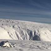
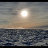

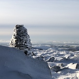
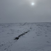 See 11 more The Cheviot photos
Bizzle Cragg up on to West Hill
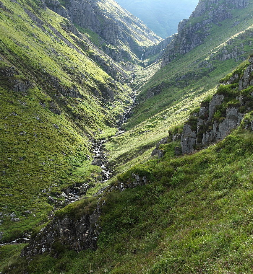
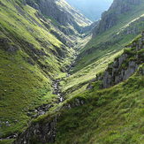
Hen Hole,The Cheviot.
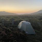
Dawn on the Hills
Bizzle Cragg up on to West Hill
Bizzle Cragg up on to West Hill
Bizzle Cragg up on to West Hill
Cheviot Summit

