– Lat/Long: 39.00° N 38.00° E
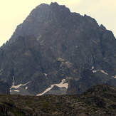
 Vercenik
Weather Forecast, TurkeyIssued: 2 am Sat 19 Apr Local TimeUpdates in: hr min sUpdate imminent
Vercenik Weather Forecast, Turkey
Issued: 2 am Sat 19 Apr Local Time
Updates in:
Update imminent hr min s

Issued: 2 am Sat 19 Apr Local Time
Updates in:
Update imminent hr min s
Days 1–3 Weather SummaryA light covering of new snow mostly falling on Sat afternoon. Temperatures will be below freezing (max -3°C on Sat afternoon, min -5°C on Sun morning). Winds decreasing (strong winds from the SW on Sat afternoon, light winds from the WSW by Mon morning). | Days 4–6 Weather SummaryA moderate fall of snow, heaviest on Wed afternoon. Temperatures will be below freezing (max -2°C on Tue night, min -7°C on Thu night). Winds increasing (light winds from the SSW on Tue morning, near gales from the SW by Wed morning). | |||||||||||||||||
Saturday 19 | Sunday 20 | Monday 21 | Tuesday 22 | Wednesday 23 | Thursday 24 | |||||||||||||
AM | PM | night | AM | PM | night | AM | PM | night | AM | PM | night | AM | PM | night | AM | PM | night | |
snow shwrs | snow shwrs | snow shwrs | some clouds | clear | clear | clear | some clouds | some clouds | some clouds | light snow | snow shwrs | cloudy | light snow | snow shwrs | clear | light snow | snow shwrs | |
km/h | ||||||||||||||||||
 |  |  |  |  |  | |||||||||||||
1.0 | 5 | 2.0 | — | — | — | — | — | — | — | 1.0 | 2.0 | — | 3 | 2.0 | — | 2.0 | 3 | |
— | — | — | — | — | — | — | — | — | — | — | — | — | — | — | — | — | — | |
max°C | -4 | -3 | -3 | -4 | -3 | -4 | -5 | -3 | -3 | -4 | -3 | -2 | -2 | -4 | -4 | -5 | -3 | -4 |
min°C | -4 | -3 | -4 | -5 | -3 | -5 | -5 | -4 | -4 | -4 | -3 | -3 | -4 | -4 | -5 | -5 | -4 | -7 |
-11 | -11 | -12 | -12 | -11 | -12 | -12 | -10 | -10 | -11 | -10 | -11 | -14 | -14 | -14 | -13 | -12 | -16 | |
3250 | 3300 | 3300 | 3200 | 3250 | 3050 | 2950 | 3250 | 3200 | 3250 | 3300 | 3350 | 3550 | 3200 | 3200 | 3000 | 3250 | 2950 | |
Cloud base (m) | 3450 | 3400 | 3200 | 3800 | 3750 | 3450 | 3450 | 6550 | 3300 | 3400 | 6500 | 2250 | 3250 | 2900 | 3050 | |||
5:46 | — | — | 5:43 | — | — | 5:43 | — | — | 5:41 | — | — | 5:39 | — | — | 5:39 | — | — | |
— | 7:07 | — | — | 7:08 | — | — | 7:09 | — | — | 7:10 | — | — | 7:12 | — | — | 7:13 | — | |
Loading...
Vercenik Weather (Days 0-3):
The weather forecast for Vercenik is: A light covering of new snow mostly falling on Sat afternoon. Temperatures will be below freezing (max -3°C on Sat afternoon, min -5°C on Sun morning). Winds decreasing (strong winds from the SW on Sat afternoon, light winds from the WSW by Mon morning).
Vercenik Weather (Days 3-6):
A moderate fall of snow, heaviest on Wed afternoon. Temperatures will be below freezing (max -2°C on Tue night, min -7°C on Thu night). Winds increasing (light winds from the SSW on Tue morning, near gales from the SW by Wed morning).
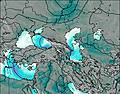
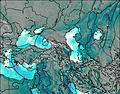
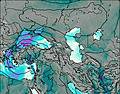
This table gives the weather forecast for Vercenik at the specific elevation of 3730 m. Our advanced weather models allow us to provide distinct weather forecasts for several elevations of Vercenik. To see the weather forecasts for the other elevations, use the tab navigation above the table. For a wider overview of the weather, consult the Weather Map of Turkey.
| Weather Station | Temp. | Weather | Wind | Gusts | Cloud / Visibility |
|---|---|---|---|---|---|
Malaty / rhac | |||||
Tulga Meydan | |||||
Erzincan Merkez | |||||
Erzincan Havalimani |
* NOTE: not all weather observatories update at the same frequency which is the reason why some locations may show data from stations that are further away than known closer ones.
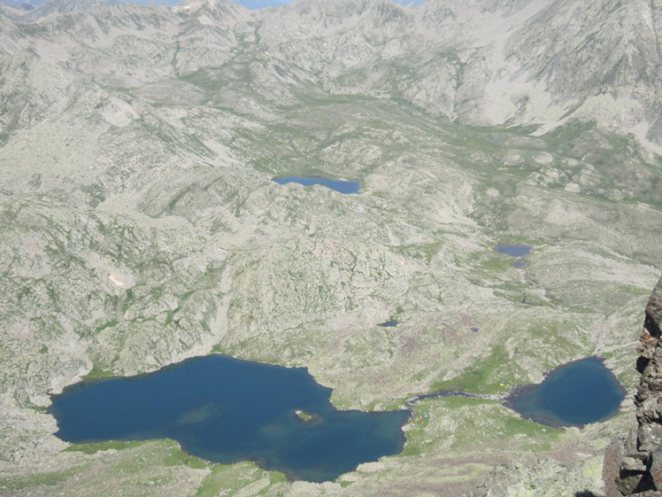
Vercenik Photos
View all
Northern Anatolia (Black Sea) photos (76) |
Anatolia photos (509) |
photos from mountains in Turkey (476) |
all photos
 Upload new photo
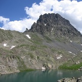

 See 11 more Vercenik photos
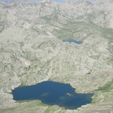
Verçenik and Lakes
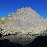
Verçenik Lakes
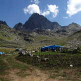
Verçenik
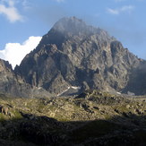
Verçenik
Verçenik
Verçenik

